Toggle navigation
Survey Documents
Advanced Search
Supporting Data
Companies
Surveyors
Communities
Original Townships
APIs
Survey Documents API
Tutorial
About
Contact
Search
0068 3 pages scanned, please download to view all scans
Download 0068.tif
GIS Data
Latitude:
41.1728499999998
Longitude:
-81.58922
Identification
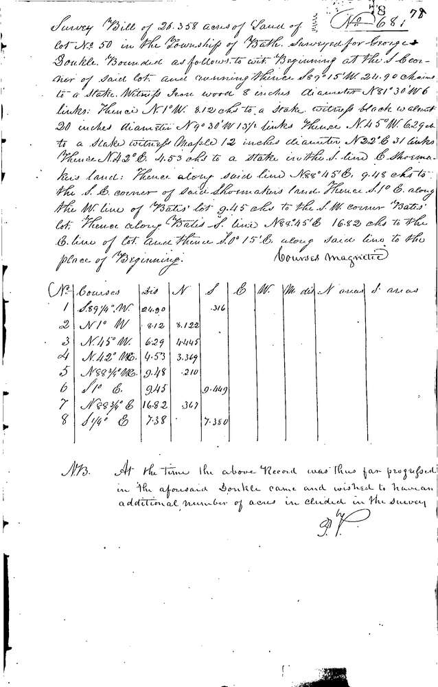
Survey identifier:
0068
Context
Original township:
Bath
Community list:
Bath
Surveyed on:
11/20/1844
Description
Owner:
Doukle, Carver
Description:
26.358 ACRES IN S.E. CORNER OF LOT 33.496 ACRES IN S. SIDE OF LOT
Primary road:
Secondary road:
Near intersection:
Acreage:
33.496
Survey Locators
Tract list:
Lot list:
50
Section list:
Quarter:
Surveyor
Surveyor number:
Surveyor name:
Company:
Summit County Surveyor
Document Data
Scan File Name:
0068.tif
Scan Pages:
3
Drawer location:
Survey Book 1 Pg 78,79