Toggle navigation
Survey Documents
Advanced Search
Supporting Data
Companies
Surveyors
Communities
Original Townships
APIs
Survey Documents API
Tutorial
About
Contact
Search
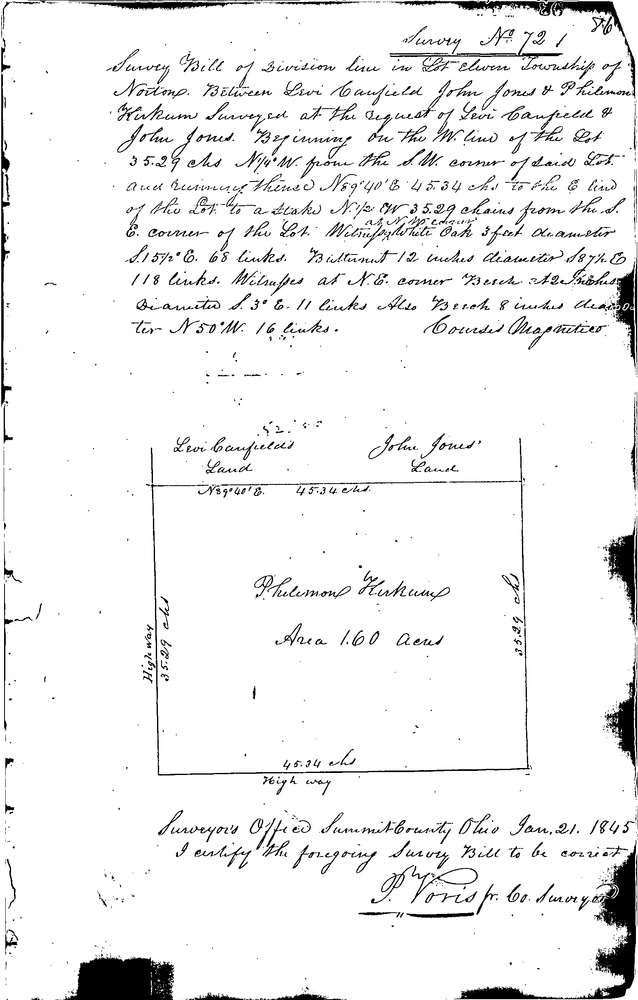
0072
Download 0072.TIF
GIS Data
Latitude:
41.0517899999998
Longitude:
-81.68347
Identification
Survey identifier:
0072
Context
Original township:
Norton
Community list:
Norton
Surveyed on:
01/21/1845
Description
Owner:
Kirkhum
Description:
DIVISION LINE N. 35.29 C.H. FROM S. LINE
Primary road:
Secondary road:
Near intersection:
Acreage:
1.6
Survey Locators
Tract list:
Lot list:
11
Section list:
Quarter:
Surveyor
Surveyor number:
Surveyor name:
Company:
Summit County Surveyor
Document Data
Scan File Name:
0072.TIF
Scan Pages:
1
Drawer location:
Survey Book 1 Pg 86