Toggle navigation
Survey Documents
Advanced Search
Supporting Data
Companies
Surveyors
Communities
Original Townships
APIs
Survey Documents API
Tutorial
About
Contact
Search
0074 2 pages scanned, please download to view all scans
Download 0074.tif
GIS Data
Latitude:
41.1694199999999
Longitude:
-81.57935
Identification
Survey identifier:
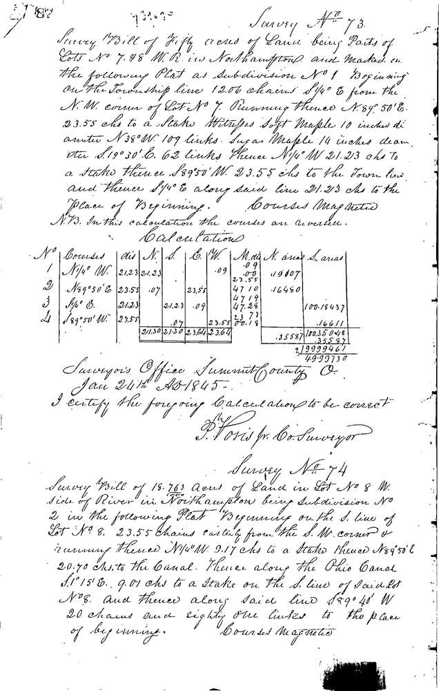
0074
Context
Original township:
Northampton
Community list:
Northampton
Surveyed on:
01/25/1845
Description
Owner:
Unknown
Description:
18.763 AC. ON N. SIDE OF LOT W. OF RIVER
Primary road:
Secondary road:
Near intersection:
Acreage:
18.763
Survey Locators
Tract list:
Lot list:
8
Section list:
Quarter:
Surveyor
Surveyor number:
Surveyor name:
Company:
Summit County Surveyor
Document Data
Scan File Name:
0074.tif
Scan Pages:
2
Drawer location:
Survey Book 1 Pg 87