Toggle navigation
Survey Documents
Advanced Search
Supporting Data
Companies
Surveyors
Communities
Original Townships
APIs
Survey Documents API
Tutorial
About
Contact
Search
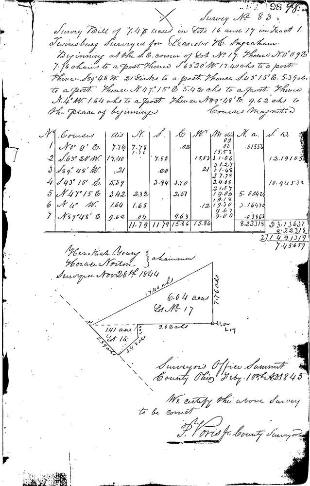
0083
Download 0083.TIF
GIS Data
Latitude:
41.3398999999999
Longitude:
-81.47567
Identification
Survey identifier:
0083
Context
Original township:
Twinsburg
Community list:
Twinsburg
Surveyed on:
02/10/1845
Description
Owner:
Ingraham
Description:
6.04 ACRES IN LOT 17 & 1.41 ACRES IN LOT 16
Primary road:
Secondary road:
Near intersection:
Acreage:
7.45
Survey Locators
Tract list:
1
Lot list:
16 & 17
Section list:
Quarter:
Surveyor
Surveyor number:
Surveyor name:
Company:
Summit County Surveyor
Document Data
Scan File Name:
0083.TIF
Scan Pages:
1
Drawer location:
Survey Book 1 Pg 98