Toggle navigation
Survey Documents
Advanced Search
Supporting Data
Companies
Surveyors
Communities
Original Townships
APIs
Survey Documents API
Tutorial
About
Contact
Search
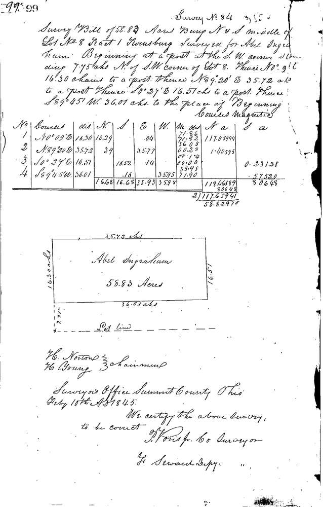
0084
Download 0084.TIF
GIS Data
Latitude:
41.3423499999999
Longitude:
-81.47026
Identification
Survey identifier:
0084
Context
Original township:
Twinsburg
Community list:
Twinsburg
Surveyed on:
02/10/1845
Description
Owner:
Ingraham
Description:
58.83 ACRES 7.75 CH NORTH OF SOUTH LINE OF LOT
Primary road:
Secondary road:
Near intersection:
Acreage:
58.83
Survey Locators
Tract list:
1
Lot list:
8
Section list:
Quarter:
Surveyor
Surveyor number:
Surveyor name:
Company:
Summit County Surveyor
Document Data
Scan File Name:
0084.TIF
Scan Pages:
1
Drawer location:
Survey Book 1 Pg 99