Toggle navigation
Survey Documents
Advanced Search
Supporting Data
Companies
Surveyors
Communities
Original Townships
APIs
Survey Documents API
Tutorial
About
Contact
Search
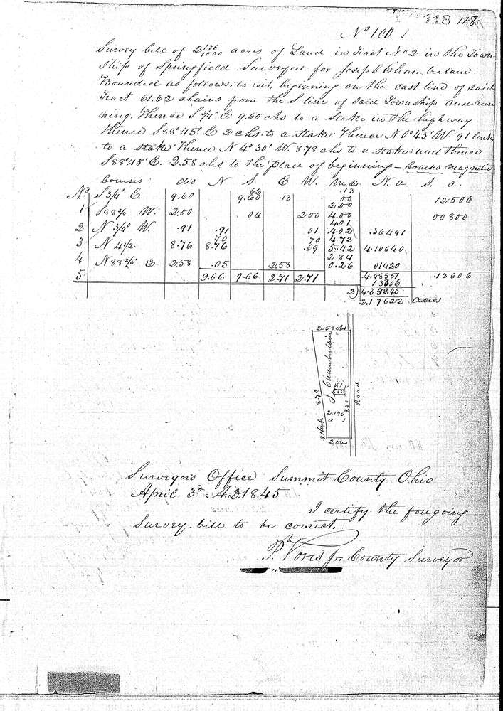
0101
Download 0101.TIF
GIS Data
Latitude:
41.0027799999999
Longitude:
-81.4764
Identification
Survey identifier:
0101
Context
Original township:
Springfield
Community list:
Springfield
Surveyed on:
04/03/1845
Description
Owner:
Chamberlain
Description:
2.176 ACRES ON EAST SIDE OF TRACT
Primary road:
Secondary road:
Near intersection:
Acreage:
2.176
Survey Locators
Tract list:
2
Lot list:
Section list:
Quarter:
Surveyor
Surveyor number:
Surveyor name:
Company:
Summit County Surveyor
Document Data
Scan File Name:
0101.TIF
Scan Pages:
1
Drawer location:
Survey Book 1 Pg 118