Toggle navigation
Survey Documents
Advanced Search
Supporting Data
Companies
Surveyors
Communities
Original Townships
APIs
Survey Documents API
Tutorial
About
Contact
Search
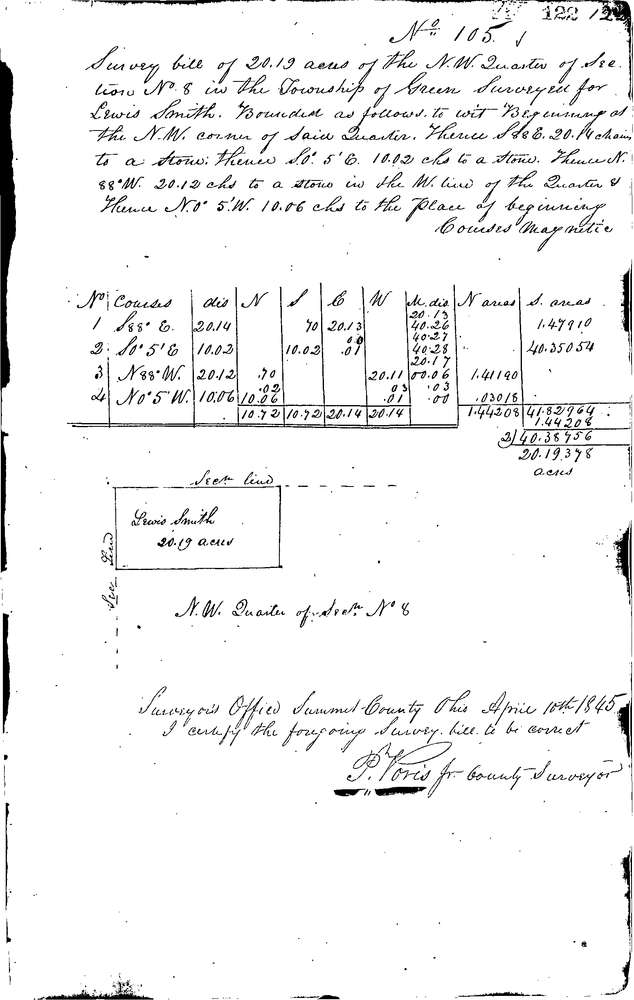
0105
Download 0105.TIF
GIS Data
Latitude:
40.9809399999998
Longitude:
-81.50828
Identification
Survey identifier:
0105
Context
Original township:
Green
Community list:
Green
Surveyed on:
04/10/1845
Description
Owner:
Smith
Description:
20.19 AC.IN N.W. 1/4 SEC.
Primary road:
Secondary road:
Near intersection:
Acreage:
20.19
Survey Locators
Tract list:
Lot list:
8
Section list:
Quarter:
Surveyor
Surveyor number:
Surveyor name:
Company:
Summit County Surveyor
Document Data
Scan File Name:
0105.TIF
Scan Pages:
1
Drawer location:
Survey Book 1 Pg 122