Toggle navigation
Survey Documents
Advanced Search
Supporting Data
Companies
Surveyors
Communities
Original Townships
APIs
Survey Documents API
Tutorial
About
Contact
Search
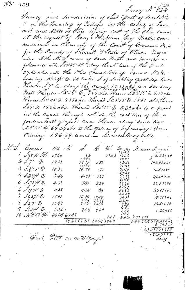
0129 12 pages scanned, please download to view all scans
Download 0129.tif
GIS Data
Latitude:
41.1008699999999
Longitude:
-81.52391
Identification
Survey identifier:
0129
Context
Original township:
Portage
Community list:
Portage
Surveyed on:
01/31/1846
Description
Owner:
Description:
196.69 ACRES ALL OF TRACT E. OF OHIO CANAL
Primary road:
Secondary road:
Near intersection:
Acreage:
196.69
Survey Locators
Tract list:
5
Lot list:
Section list:
Quarter:
Surveyor
Surveyor number:
Surveyor name:
Company:
Summit County Surveyor
Document Data
Scan File Name:
0129.tif
Scan Pages:
12
Drawer location:
Survey Book 1 Pg 149