Toggle navigation
Survey Documents
Advanced Search
Supporting Data
Companies
Surveyors
Communities
Original Townships
APIs
Survey Documents API
Tutorial
About
Contact
Search
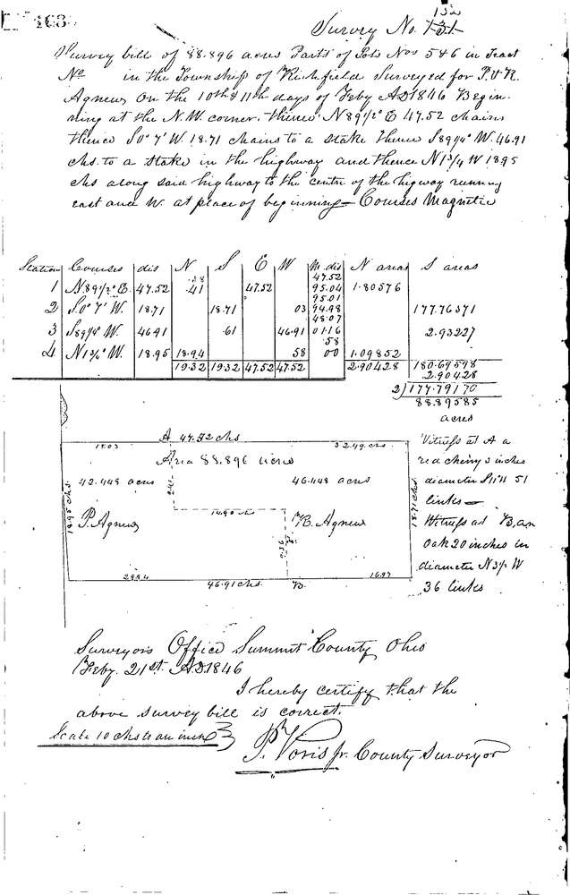
0132
Download 0132.TIF
GIS Data
Latitude:
41.2605299999999
Longitude:
-81.60407
Identification
Survey identifier:
0132
Context
Original township:
Richfield
Community list:
Richfield
Surveyed on:
02/21/1846
Description
Owner:
Agnew
Description:
88.896 ACRES
Primary road:
Secondary road:
Near intersection:
Acreage:
88.896
Survey Locators
Tract list:
Lot list:
5 & 6
Section list:
Quarter:
Surveyor
Surveyor number:
Surveyor name:
Company:
Summit County Surveyor
Document Data
Scan File Name:
0132.TIF
Scan Pages:
1
Drawer location:
Survey Book 1 Pg 163