Toggle navigation
Survey Documents
Advanced Search
Supporting Data
Companies
Surveyors
Communities
Original Townships
APIs
Survey Documents API
Tutorial
About
Contact
Search
0145 2 pages scanned, please download to view all scans
Download 0145.tif
GIS Data
Latitude:
41.0470699999999
Longitude:
-81.58579
Identification
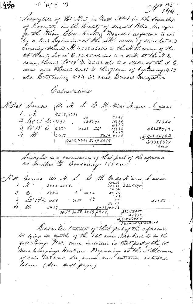
Survey identifier:
0145
Context
Original township:
Coventry
Community list:
Coventry
Surveyed on:
08/28/1846
Description
Owner:
Newton
Description:
234.28 ACRES IN N. END OF LOT
Primary road:
Secondary road:
Near intersection:
Acreage:
234.28
Survey Locators
Tract list:
1
Lot list:
2
Section list:
Quarter:
Surveyor
Surveyor number:
Surveyor name:
Company:
Summit County Surveyor
Document Data
Scan File Name:
0145.tif
Scan Pages:
2
Drawer location:
Survey Book 1 Pg 179