Toggle navigation
Survey Documents
Advanced Search
Supporting Data
Companies
Surveyors
Communities
Original Townships
APIs
Survey Documents API
Tutorial
About
Contact
Search
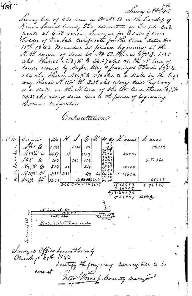
0146
Download 0146.TIF
GIS Data
Latitude:
41.0315299999998
Longitude:
-81.5948
Identification
Survey identifier:
0146
Context
Original township:
Norton
Community list:
Norton
Surveyed on:
08/29/1846
Description
Owner:
Viers
Description:
4.32 ACRES IN N. END OF LOT
Primary road:
Secondary road:
Near intersection:
Acreage:
4.32
Survey Locators
Tract list:
Lot list:
50
Section list:
Quarter:
Surveyor
Surveyor number:
Surveyor name:
Company:
Summit County Surveyor
Document Data
Scan File Name:
0146.TIF
Scan Pages:
1
Drawer location:
Survey Book 1 Pg 181