Toggle navigation
Survey Documents
Advanced Search
Supporting Data
Companies
Surveyors
Communities
Original Townships
APIs
Survey Documents API
Tutorial
About
Contact
Search
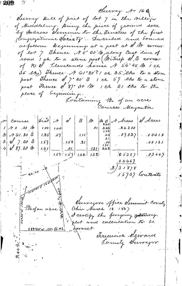
0167
Download 0167.TIF
GIS Data
Latitude:
41.0707899999998
Longitude:
-81.48912
Identification
Survey identifier:
0167
Context
Original township:
Tallmadge
Community list:
Akron
Surveyed on:
03/13/1847
Description
Owner:
Trustees 1st Congregational Society
Description:
Lot 7 Village of Middlebury
Primary road:
Secondary road:
Near intersection:
Acreage:
0.16
Survey Locators
Tract list:
Lot list:
Section list:
Quarter:
Surveyor
Surveyor number:
Surveyor name:
Company:
Summit County Surveyor
Document Data
Scan File Name:
0167.TIF
Scan Pages:
1
Drawer location:
Survey Book 1 Pg 209