Toggle navigation
Survey Documents
Advanced Search
Supporting Data
Companies
Surveyors
Communities
Original Townships
APIs
Survey Documents API
Tutorial
About
Contact
Search
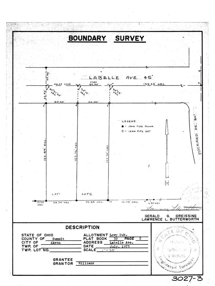
3027-3
Download lotsplits3027_3.tif
GIS Data
Latitude:
41.0707899999998
Longitude:
-81.560365
Identification
Survey identifier:
3027-3
Context
Original township:
Akron
Community list:
Akron
Surveyed on:
07/01/1973
Description
Owner:
Williams
Description:
Lowy Subdivision Pb 39 Pg 2
Primary road:
Labelle Ave
Secondary road:
Near intersection:
Packard Dr
Acreage:
Survey Locators
Tract list:
Lot list:
Section list:
Quarter:
Surveyor
Surveyor number:
5916
Surveyor name:
Butterworth, Lawrence L.
Company:
Document Data
Scan File Name:
lotsplits3027_3.tif
Scan Pages:
1
Drawer location: