Toggle navigation
Survey Documents
Advanced Search
Supporting Data
Companies
Surveyors
Communities
Original Townships
APIs
Survey Documents API
Tutorial
About
Contact
Search
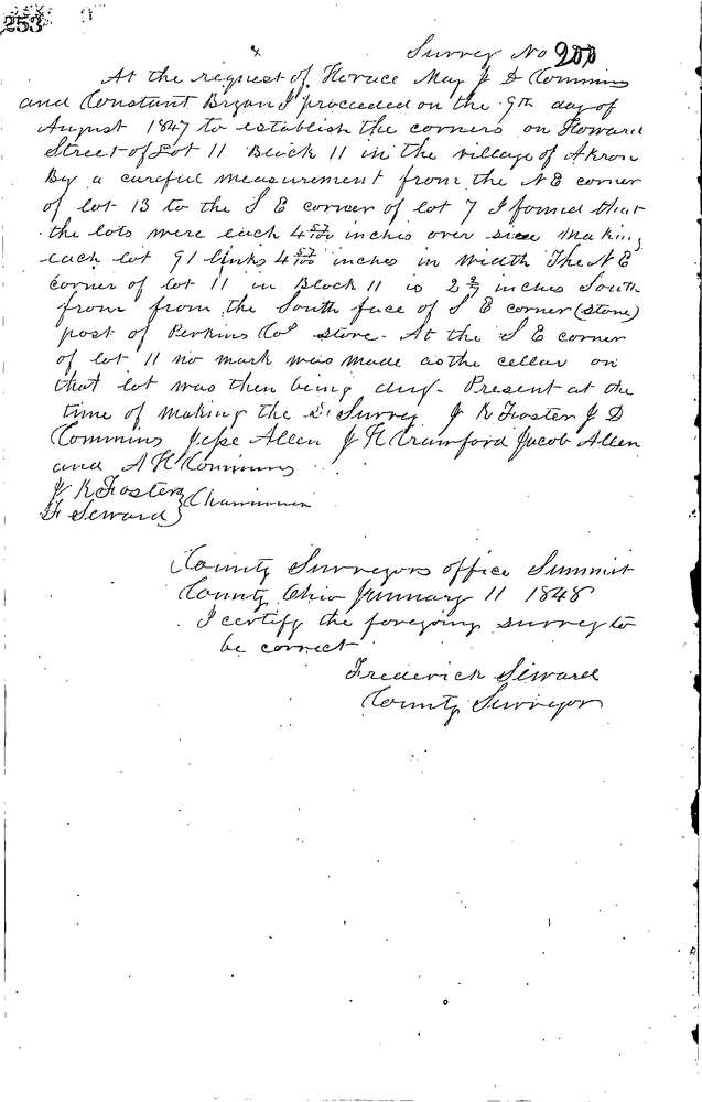
0200
Download 0200.TIF
GIS Data
Latitude:
41.0868699999998
Longitude:
-81.51717
Identification
Survey identifier:
0200
Context
Original township:
Akron
Community list:
Akron
Surveyed on:
01/11/1848
Description
Owner:
May, Cummins, Bryan
Description:
W. SIDE OF S. HOWARD ST.
Primary road:
Howard St
Secondary road:
Near intersection:
Acreage:
Survey Locators
Tract list:
11
Lot list:
11
Section list:
Quarter:
Surveyor
Surveyor number:
Surveyor name:
Company:
Summit County Surveyor
Document Data
Scan File Name:
0200.TIF
Scan Pages:
1
Drawer location:
Survey Book 1 Pg 253