Toggle navigation
Survey Documents
Advanced Search
Supporting Data
Companies
Surveyors
Communities
Original Townships
APIs
Survey Documents API
Tutorial
About
Contact
Search
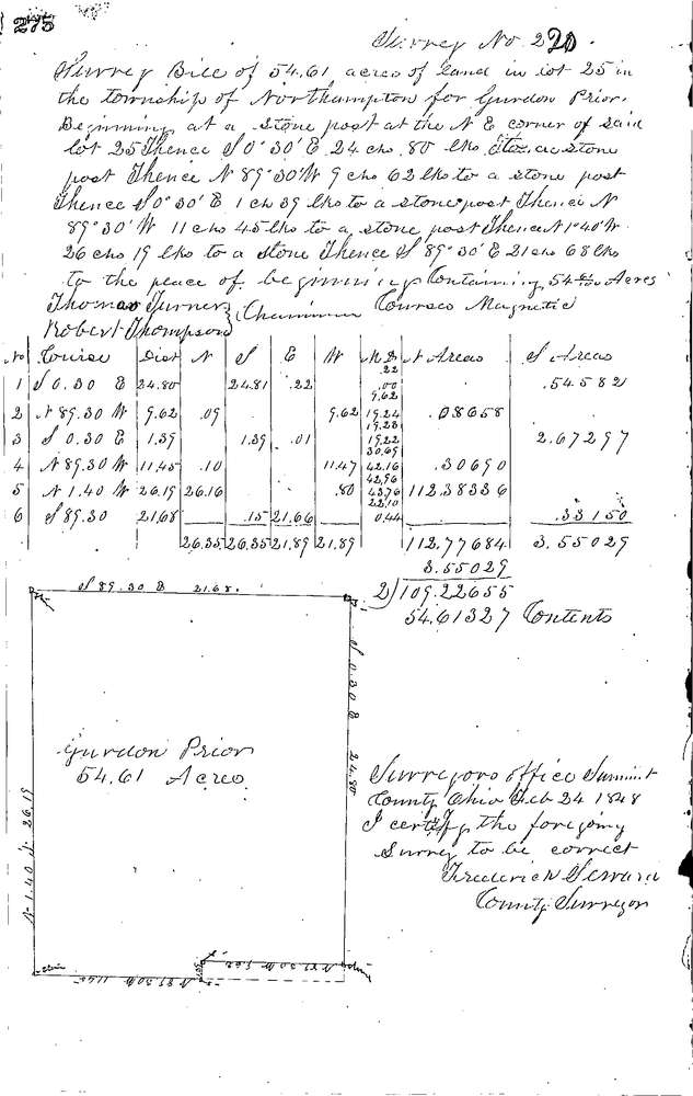
0220
Download 0220.TIF
GIS Data
Latitude:
41.1694199999999
Longitude:
-81.51275
Identification
Survey identifier:
0220
Context
Original township:
Northampton
Community list:
Northampton
Surveyed on:
02/24/1848
Description
Owner:
Prior
Description:
54.61 AC. IN N.E. PART OF LOT
Primary road:
Secondary road:
Near intersection:
Acreage:
54.61
Survey Locators
Tract list:
Lot list:
25
Section list:
Quarter:
Surveyor
Surveyor number:
Surveyor name:
Company:
Summit County Surveyor
Document Data
Scan File Name:
0220.TIF
Scan Pages:
1
Drawer location:
Survey Book 1 Pg 275