Toggle navigation
Survey Documents
Advanced Search
Supporting Data
Companies
Surveyors
Communities
Original Townships
APIs
Survey Documents API
Tutorial
About
Contact
Search
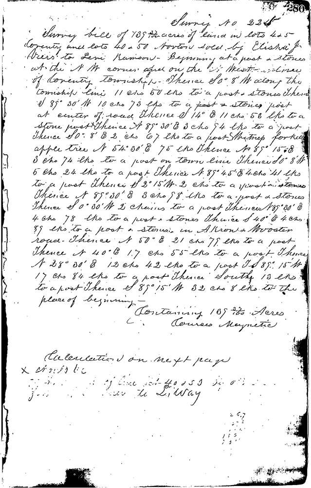
0225 3 pages scanned, please download to view all scans
Download 0225.tif
GIS Data
Latitude:
41.0418899999999
Longitude:
-81.58047
Identification
Survey identifier:
0225
Context
Original township:
Coventry
Community list:
Coventry
Surveyed on:
05/26/1848
Description
Owner:
Viers to Ramson
Description:
139.37 ACRES (PART IN NORTON TWP)
Primary road:
Secondary road:
Near intersection:
Acreage:
139.37
Survey Locators
Tract list:
1
Lot list:
4, 5
Section list:
Quarter:
Surveyor
Surveyor number:
Surveyor name:
Company:
Summit County Surveyor
Document Data
Scan File Name:
0225.tif
Scan Pages:
3
Drawer location:
Survey Book 1 Pg 280