Toggle navigation
Survey Documents
Advanced Search
Supporting Data
Companies
Surveyors
Communities
Original Townships
APIs
Survey Documents API
Tutorial
About
Contact
Search
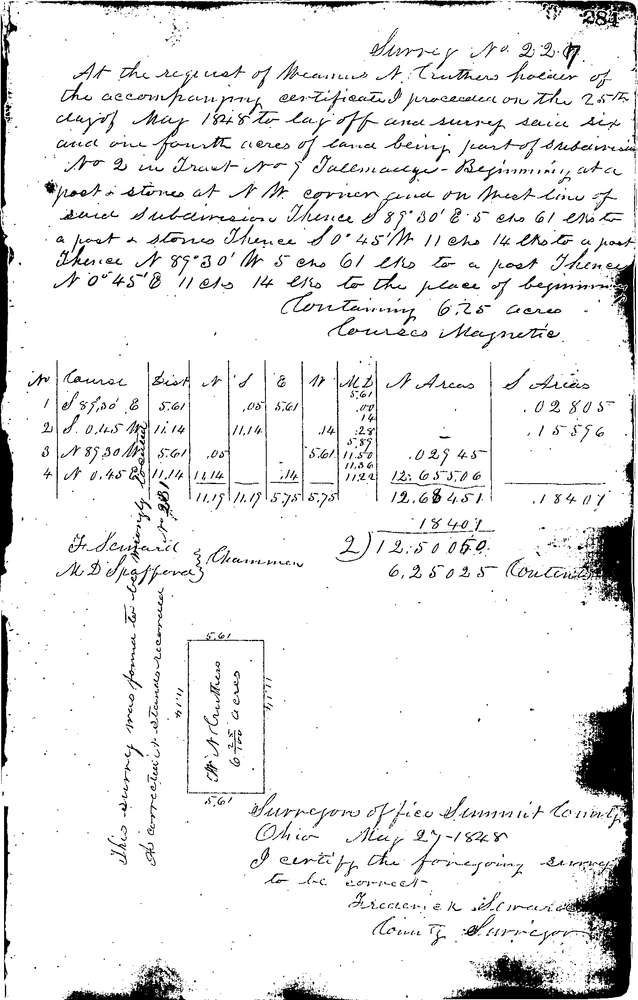
0227
Download 0227.TIF
GIS Data
Latitude:
41.0997399999998
Longitude:
-81.47893
Identification
Survey identifier:
0227
Context
Original township:
Tallmadge
Community list:
Tallmadge
Surveyed on:
05/27/1848
Description
Owner:
Cruthers
Description:
6.25 ACRES
Primary road:
Secondary road:
Near intersection:
Acreage:
6.25
Survey Locators
Tract list:
9
Lot list:
2
Section list:
Quarter:
Surveyor
Surveyor number:
Surveyor name:
Company:
Summit County Surveyor
Document Data
Scan File Name:
0227.TIF
Scan Pages:
1
Drawer location:
Survey Book 1 Pg 284