Toggle navigation
Survey Documents
Advanced Search
Supporting Data
Companies
Surveyors
Communities
Original Townships
APIs
Survey Documents API
Tutorial
About
Contact
Search
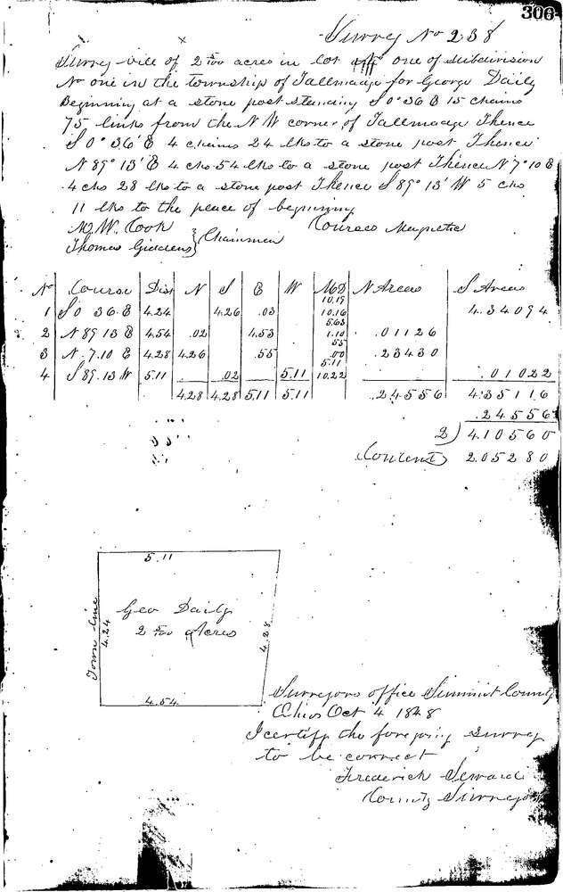
0238
Download 0238.TIF
GIS Data
Latitude:
41.1287099999999
Longitude:
-81.47541
Identification
Survey identifier:
0238
Context
Original township:
Tallmadge
Community list:
Cuyahoga Falls
Surveyed on:
10/04/1848
Description
Owner:
Daily
Description:
2.05AC.15.75 CH. S OF N.W. COR.OF LOT FORMERLY TAL
Primary road:
Secondary road:
Near intersection:
Acreage:
2.05
Survey Locators
Tract list:
1
Lot list:
1
Section list:
Quarter:
Surveyor
Surveyor number:
Surveyor name:
Company:
Summit County Surveyor
Document Data
Scan File Name:
0238.TIF
Scan Pages:
1
Drawer location:
Survey Book 1 Pg 306