Toggle navigation
Survey Documents
Advanced Search
Supporting Data
Companies
Surveyors
Communities
Original Townships
APIs
Survey Documents API
Tutorial
About
Contact
Search
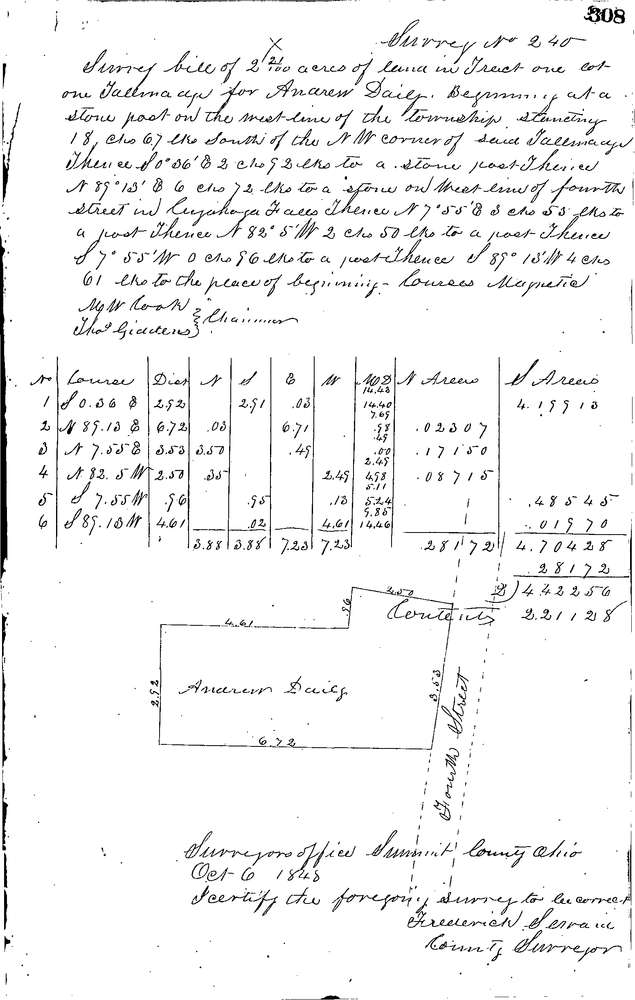
0240
Download 0240.TIF
GIS Data
Latitude:
41.1320399999999
Longitude:
-81.4882
Identification
Survey identifier:
0240
Context
Original township:
Tallmadge
Community list:
Tallmadge
Surveyed on:
10/06/1848
Description
Owner:
Daily
Description:
2.50 ACRES ON W. LINE 4th STREET CUYAHOGA FALLS
Primary road:
Fourth St
Secondary road:
Near intersection:
Acreage:
2.5
Survey Locators
Tract list:
1
Lot list:
1
Section list:
Quarter:
Surveyor
Surveyor number:
Surveyor name:
Company:
Summit County Surveyor
Document Data
Scan File Name:
0240.TIF
Scan Pages:
1
Drawer location:
Survey Book 1 Pg 307