Toggle navigation
Survey Documents
Advanced Search
Supporting Data
Companies
Surveyors
Communities
Original Townships
APIs
Survey Documents API
Tutorial
About
Contact
Search
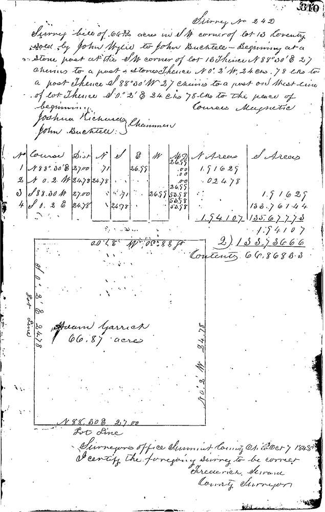
0242
Download 0242.TIF
GIS Data
Latitude:
40.9901399999998
Longitude:
-81.49632
Identification
Survey identifier:
0242
Context
Original township:
Coventry
Community list:
Coventry
Surveyed on:
10/07/1848
Description
Owner:
Wylie
Description:
Primary road:
Secondary road:
Near intersection:
Acreage:
66.87
Survey Locators
Tract list:
13
Lot list:
Section list:
Quarter:
Surveyor
Surveyor number:
Surveyor name:
Company:
Summit County Surveyor
Document Data
Scan File Name:
0242.TIF
Scan Pages:
1
Drawer location:
Survey Book 1 Pg 310