Toggle navigation
Survey Documents
Advanced Search
Supporting Data
Companies
Surveyors
Communities
Original Townships
APIs
Survey Documents API
Tutorial
About
Contact
Search
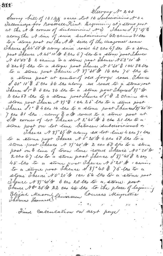
0243 3 pages scanned, please download to view all scans
Download 0243.tif
GIS Data
Latitude:
41.0732799999998
Longitude:
-81.48266
Identification
Survey identifier:
0243
Context
Original township:
Tallmadge
Community list:
Tallmadge
Surveyed on:
10/04/1848
Description
Owner:
Kent
Description:
131.44 ACRES NEAR S.E. CORNER OF LOT 3
Primary road:
Eastland Ave
Secondary road:
Near intersection:
Newton St
Acreage:
131.44
Survey Locators
Tract list:
13
Lot list:
3 & 5
Section list:
Quarter:
Surveyor
Surveyor number:
Surveyor name:
Company:
Summit County Surveyor
Document Data
Scan File Name:
0243.tif
Scan Pages:
3
Drawer location:
Survey Book 1 Pg 311