Toggle navigation
Survey Documents
Advanced Search
Supporting Data
Companies
Surveyors
Communities
Original Townships
APIs
Survey Documents API
Tutorial
About
Contact
Search
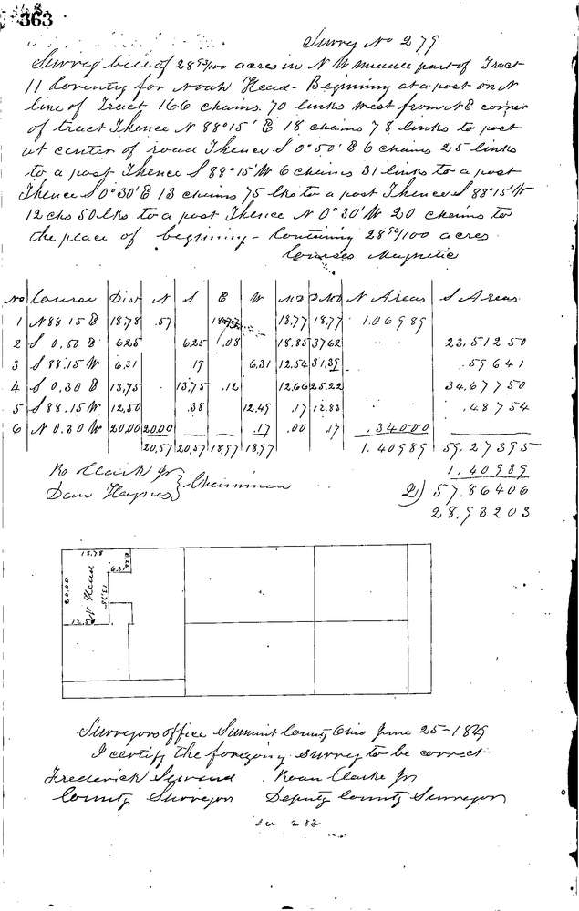
0279
Download 0279.TIF
GIS Data
Latitude:
41.0306899999998
Longitude:
-81.54639
Identification
Survey identifier:
0279
Context
Original township:
Coventry
Community list:
Coventry
Surveyed on:
06/25/1849
Description
Owner:
Nead
Description:
28.93 ACRES IN N.W. MIDDLE PART OF LOT
Primary road:
Secondary road:
Near intersection:
Acreage:
28.93
Survey Locators
Tract list:
11
Lot list:
Section list:
Quarter:
Surveyor
Surveyor number:
Surveyor name:
Company:
Summit County Surveyor
Document Data
Scan File Name:
0279.TIF
Scan Pages:
1
Drawer location:
Survey Book 1 Pg 363