Toggle navigation
Survey Documents
Advanced Search
Supporting Data
Companies
Surveyors
Communities
Original Townships
APIs
Survey Documents API
Tutorial
About
Contact
Search
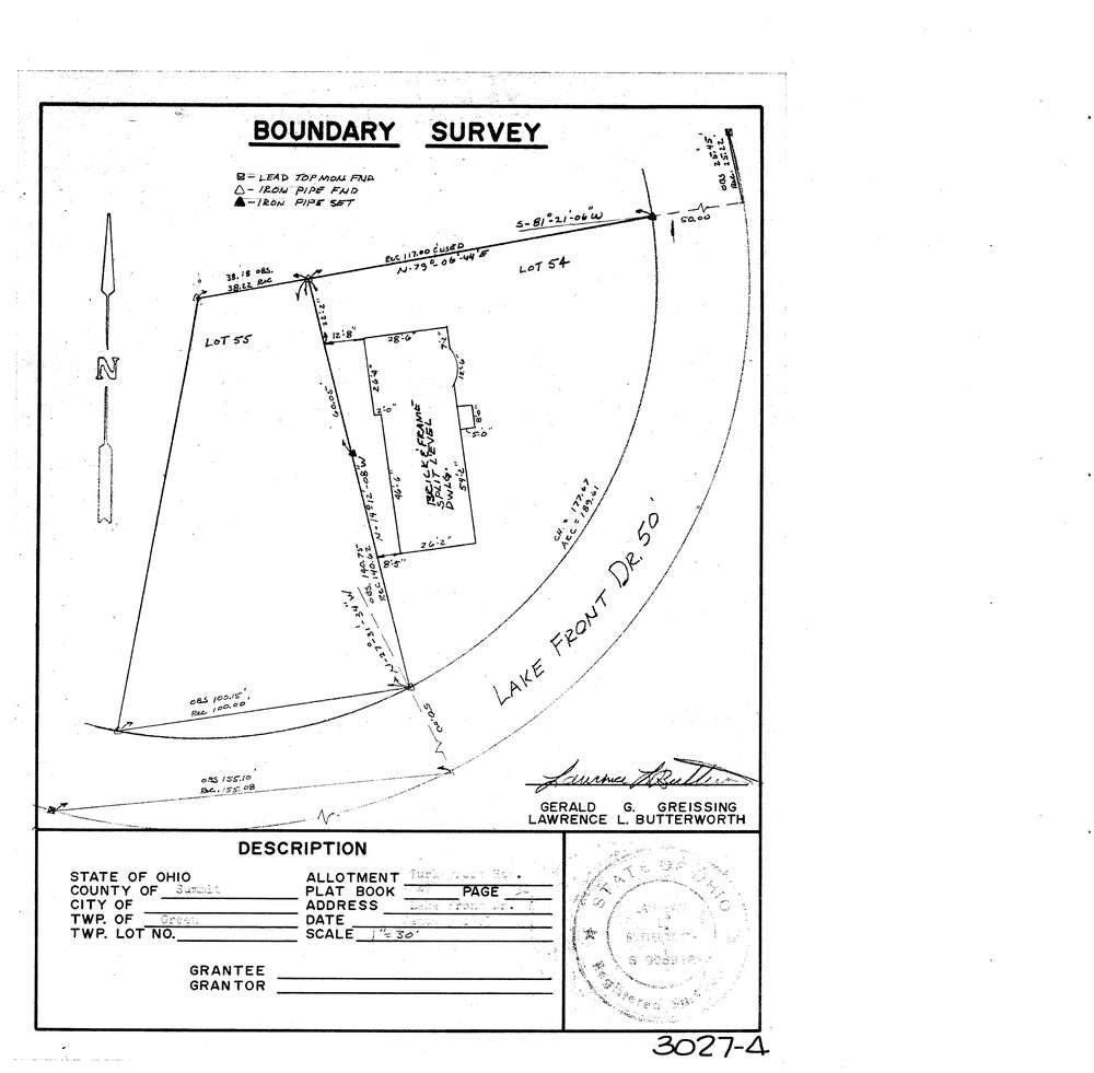
3027-4
Download lotsplits3027_4.tif
GIS Data
Latitude:
40.9856889999999
Longitude:
-81.525652
Identification
Survey identifier:
3027-4
Context
Original township:
Green
Community list:
Green
Surveyed on:
01/01/1973
Description
Owner:
Description:
Turkeyfoot Heights Pb 47 Pg 32
Primary road:
Lake Front Dr
Secondary road:
Near intersection:
Chesterfield Dr
Acreage:
Survey Locators
Tract list:
Lot list:
Section list:
Quarter:
Surveyor
Surveyor number:
5916
Surveyor name:
Butterworth, Lawrence L.
Company:
Document Data
Scan File Name:
lotsplits3027_4.tif
Scan Pages:
1
Drawer location: