Toggle navigation
Survey Documents
Advanced Search
Supporting Data
Companies
Surveyors
Communities
Original Townships
APIs
Survey Documents API
Tutorial
About
Contact
Search
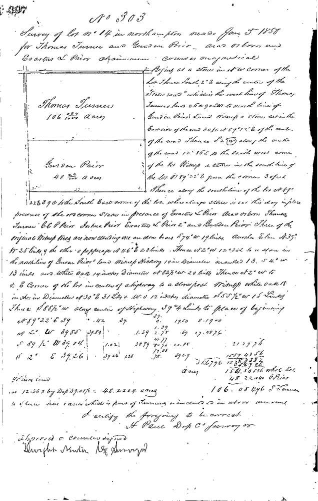
0303
Download 0303.TIF
GIS Data
Latitude:
41.1791199999998
Longitude:
-81.50391
Identification
Survey identifier:
0303
Context
Original township:
Northampton
Community list:
Northampton
Surveyed on:
01/05/1850
Description
Owner:
Turner & Prior
Description:
154.30 AC. ALL OF LOT E. OF RIVER
Primary road:
Secondary road:
Near intersection:
Acreage:
154.3
Survey Locators
Tract list:
Lot list:
14
Section list:
Quarter:
Surveyor
Surveyor number:
Surveyor name:
Company:
Summit County Surveyor
Document Data
Scan File Name:
0303.TIF
Scan Pages:
1
Drawer location:
Survey Book 1 Pg 397