Toggle navigation
Survey Documents
Advanced Search
Supporting Data
Companies
Surveyors
Communities
Original Townships
APIs
Survey Documents API
Tutorial
About
Contact
Search
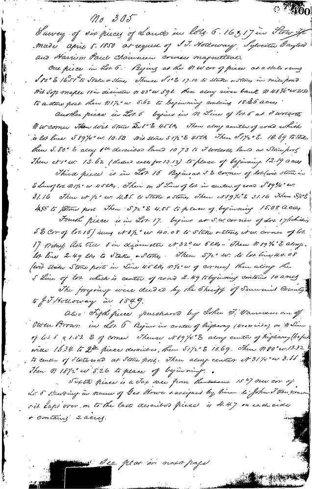
0305 3 pages scanned, please download to view all scans
Download 0305.tif
GIS Data
Latitude:
41.1447999999998
Longitude:
-81.4349
Identification
Survey identifier:
0305
Context
Original township:
Stow
Community list:
Munroe Falls
Surveyed on:
04/08/1850
Description
Owner:
Holloway
Description:
6 PARCELS OF LAND
Primary road:
Secondary road:
Near intersection:
Acreage:
Survey Locators
Tract list:
Lot list:
6, 16 & 17
Section list:
Quarter:
Surveyor
Surveyor number:
Surveyor name:
Company:
Summit County Surveyor
Document Data
Scan File Name:
0305.tif
Scan Pages:
3
Drawer location:
Survey Book 1 Pg 400