Toggle navigation
Survey Documents
Advanced Search
Supporting Data
Companies
Surveyors
Communities
Original Townships
APIs
Survey Documents API
Tutorial
About
Contact
Search
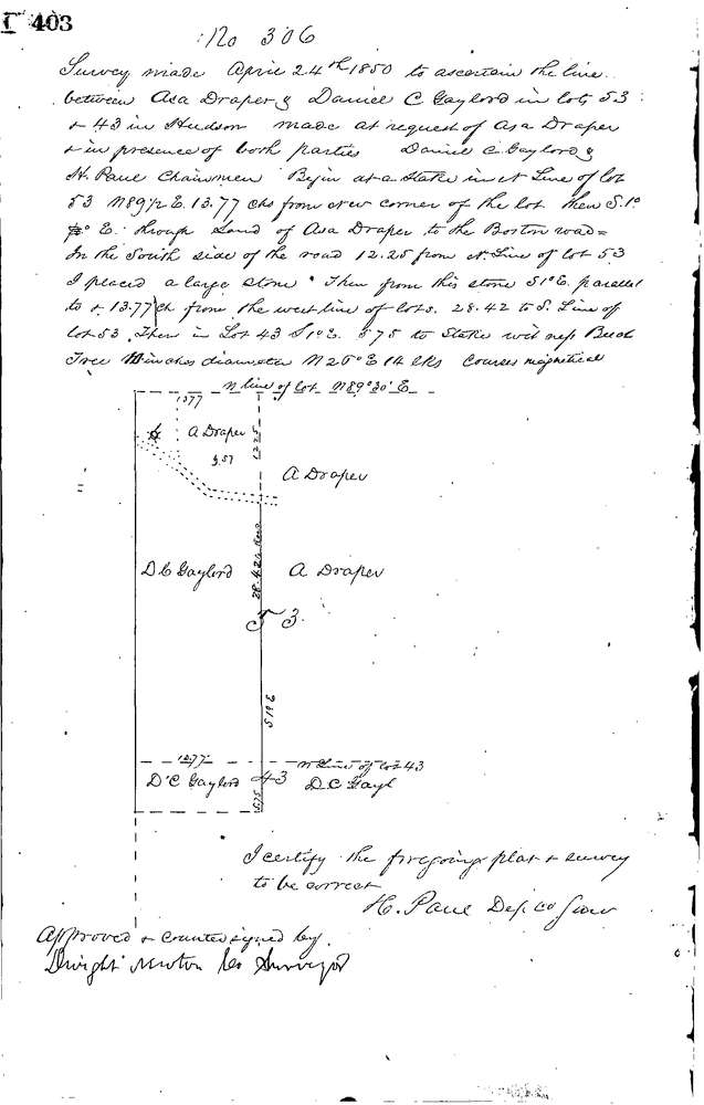
0306
Download 0306.TIF
GIS Data
Latitude:
41.2403899999999
Longitude:
-81.46477
Identification
Survey identifier:
0306
Context
Original township:
Hudson
Community list:
Hudson
Surveyed on:
04/24/1850
Description
Owner:
Draper & Gaylord
Description:
TO ESTABLISH DIVISION LINE
Primary road:
Secondary road:
Near intersection:
Acreage:
Survey Locators
Tract list:
Lot list:
43-53
Section list:
Quarter:
Surveyor
Surveyor number:
Surveyor name:
Company:
Summit County Surveyor
Document Data
Scan File Name:
0306.TIF
Scan Pages:
1
Drawer location:
Survey Book 1 Pg 403