Toggle navigation
Survey Documents
Advanced Search
Supporting Data
Companies
Surveyors
Communities
Original Townships
APIs
Survey Documents API
Tutorial
About
Contact
Search
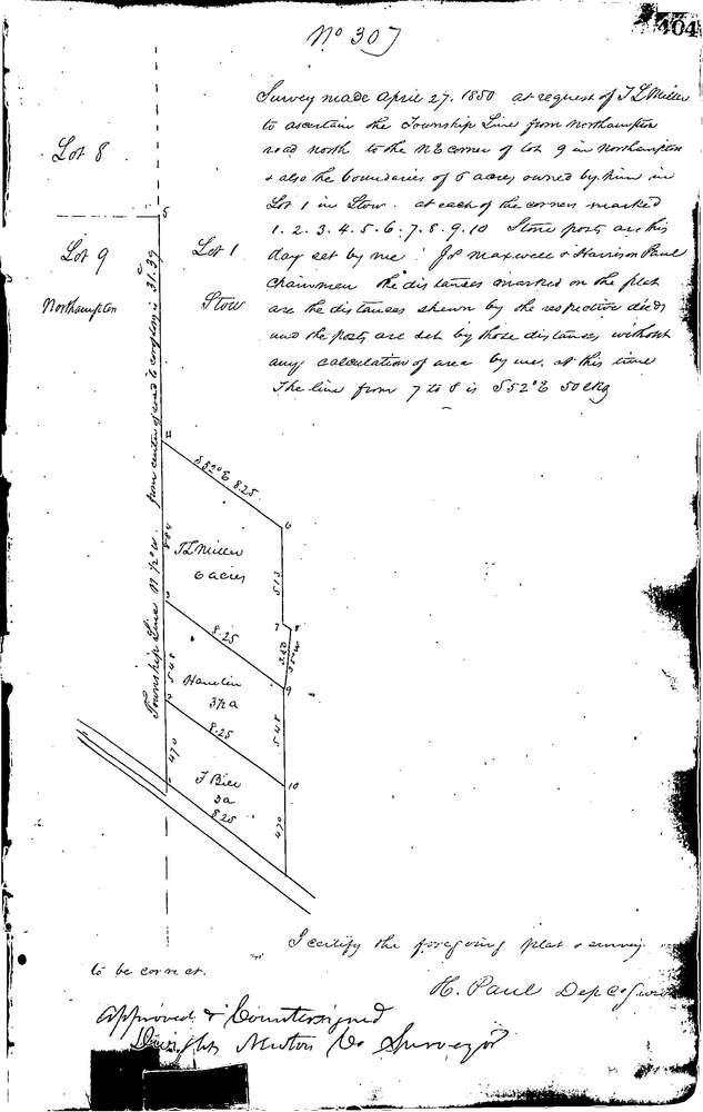
0307
Download 0307.TIF
GIS Data
Latitude:
41.1393099999998
Longitude:
-81.4882
Identification
Survey identifier:
0307
Context
Original township:
Northampton,Stow
Community list:
Northampton
Surveyed on:
04/27/1850
Description
Owner:
Miller
Description:
TO LOCATE TWP LINE FROM N.E. COR. OF LOT SOUTHERLY
Primary road:
Portage Trail
Secondary road:
Near intersection:
Acreage:
Survey Locators
Tract list:
Lot list:
9
Section list:
Quarter:
Surveyor
Surveyor number:
Surveyor name:
Company:
Summit County Surveyor
Document Data
Scan File Name:
0307.TIF
Scan Pages:
1
Drawer location:
Survey Book 1 Pg 404