Toggle navigation
Survey Documents
Advanced Search
Supporting Data
Companies
Surveyors
Communities
Original Townships
APIs
Survey Documents API
Tutorial
About
Contact
Search
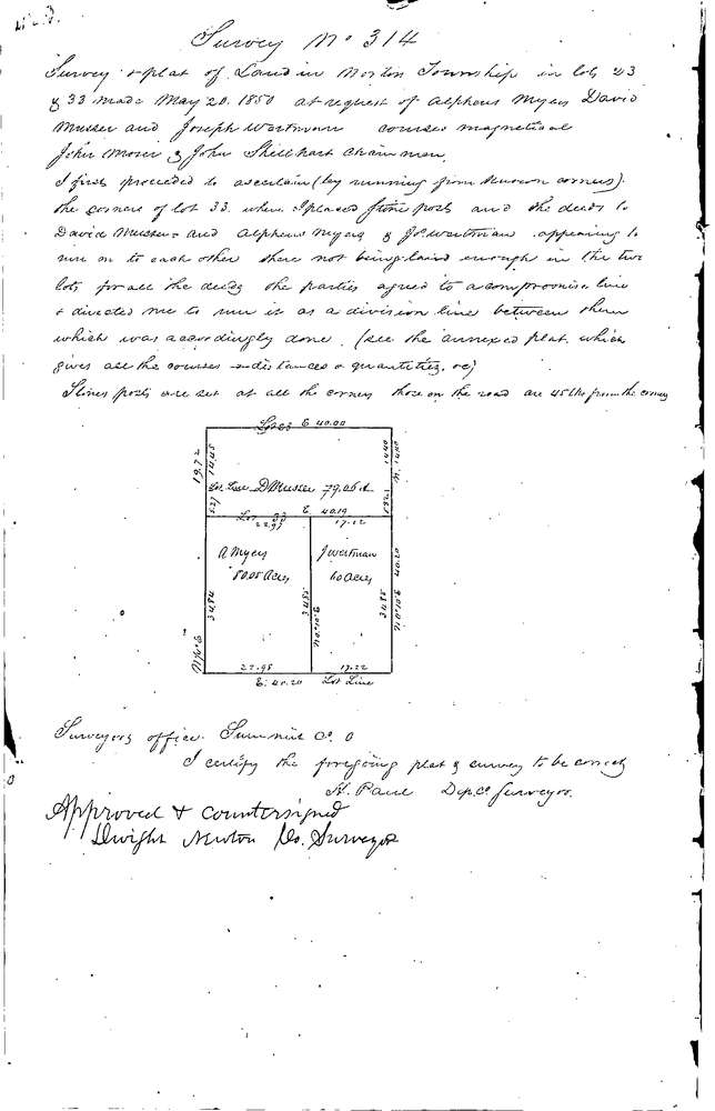
0314
Download 0314.TIF
GIS Data
Latitude:
41.0414399999999
Longitude:
-81.66029
Identification
Survey identifier:
0314
Context
Original township:
Norton
Community list:
Norton
Surveyed on:
05/20/1850
Description
Owner:
Myers, Musser, Wortman
Description:
VARIOUS PARCELS
Primary road:
Secondary road:
Near intersection:
Acreage:
Survey Locators
Tract list:
Lot list:
23 & 33
Section list:
Quarter:
Surveyor
Surveyor number:
Surveyor name:
Company:
Summit County Surveyor
Document Data
Scan File Name:
0314.TIF
Scan Pages:
1
Drawer location:
Survey Book 1 Pg 429