Toggle navigation
Survey Documents
Advanced Search
Supporting Data
Companies
Surveyors
Communities
Original Townships
APIs
Survey Documents API
Tutorial
About
Contact
Search
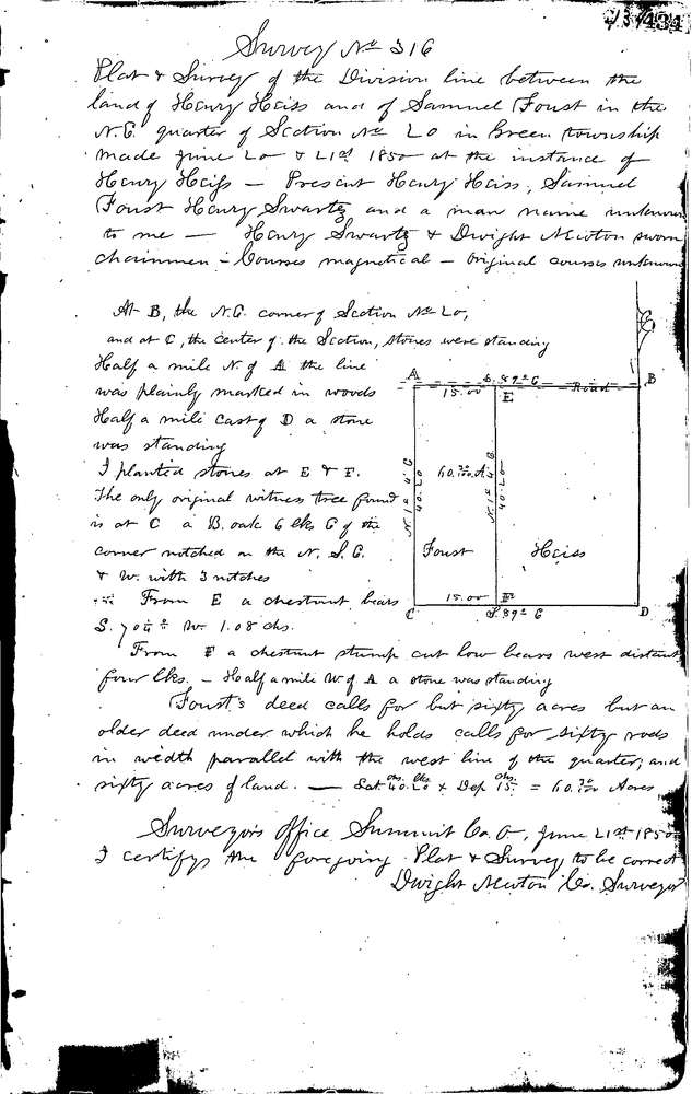
0316
Download 0316.TIF
GIS Data
Latitude:
40.9508699999998
Longitude:
-81.49781
Identification
Survey identifier:
0316
Context
Original township:
Green
Community list:
Green
Surveyed on:
06/21/1850
Description
Owner:
Heiss & Foust
Description:
DIVISION LINE BETWEEN PROPERTIES
Primary road:
E. Caston Rd
Secondary road:
Near intersection:
Acreage:
Survey Locators
Tract list:
Lot list:
20
Section list:
Quarter:
Surveyor
Surveyor number:
Surveyor name:
Company:
Summit County Surveyor
Document Data
Scan File Name:
0316.TIF
Scan Pages:
1
Drawer location:
Survey Book 1 Pg 434