Toggle navigation
Survey Documents
Advanced Search
Supporting Data
Companies
Surveyors
Communities
Original Townships
APIs
Survey Documents API
Tutorial
About
Contact
Search
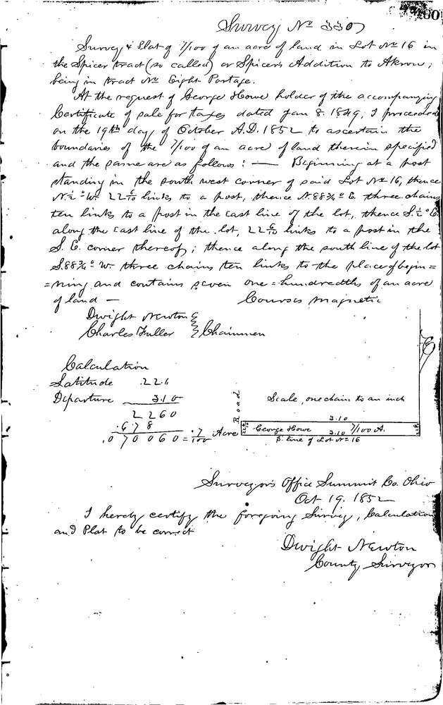
0330
Download 0330.TIF
GIS Data
Latitude:
41.0691999999998
Longitude:
-81.50897
Identification
Survey identifier:
0330
Context
Original township:
Portage
Community list:
Akron
Surveyed on:
10/19/1852
Description
Owner:
Howe
Description:
Spicer's Addition to Akron
Primary road:
Secondary road:
Near intersection:
Acreage:
0.07
Survey Locators
Tract list:
8
Lot list:
16
Section list:
Quarter:
Surveyor
Surveyor number:
Surveyor name:
Company:
Summit County Surveyor
Document Data
Scan File Name:
0330.TIF
Scan Pages:
1
Drawer location:
Survey Book 1 Pg 460