Toggle navigation
Survey Documents
Advanced Search
Supporting Data
Companies
Surveyors
Communities
Original Townships
APIs
Survey Documents API
Tutorial
About
Contact
Search
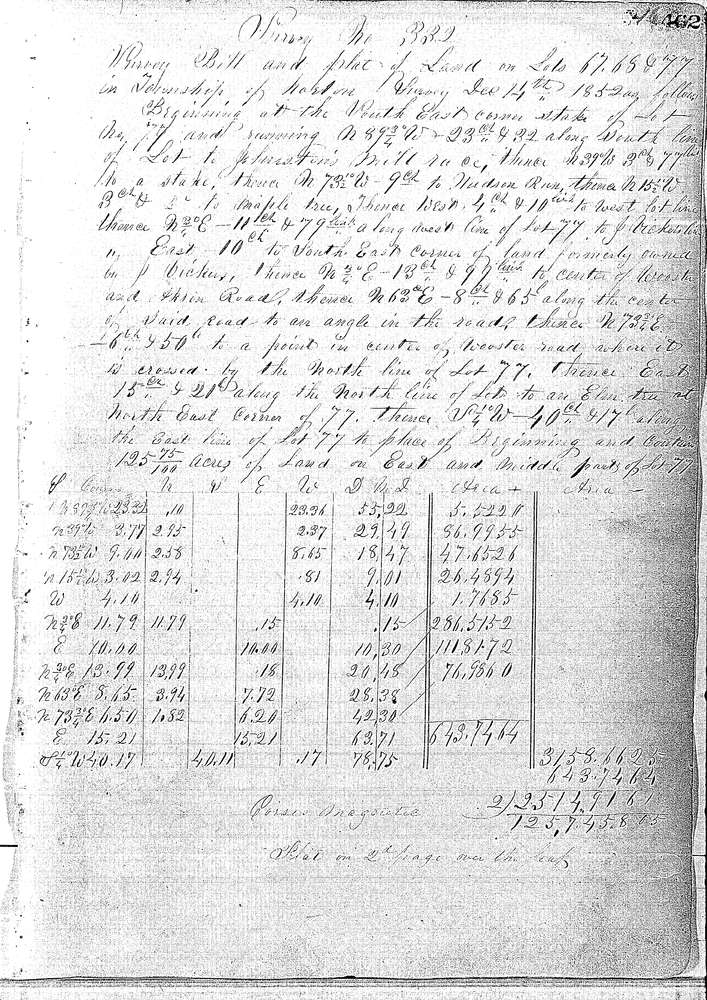
0332 3 pages scanned, please download to view all scans
Download 0332.tif
GIS Data
Latitude:
41.0106099999999
Longitude:
-81.62098
Identification
Survey identifier:
0332
Context
Original township:
Norton
Community list:
Norton
Surveyed on:
12/14/1852
Description
Owner:
Bauer
Description:
3.38 A. LOT 67, 4.23 A. LOT 68 & 125.75 A. LOT 77
Primary road:
Wooster Rd
Secondary road:
Near intersection:
Acreage:
3.38
Survey Locators
Tract list:
Lot list:
67, 68 & 77
Section list:
Quarter:
Surveyor
Surveyor number:
Surveyor name:
Company:
Summit County Surveyor
Document Data
Scan File Name:
0332.tif
Scan Pages:
3
Drawer location:
Survey Book 1 Pg 462