Toggle navigation
Survey Documents
Advanced Search
Supporting Data
Companies
Surveyors
Communities
Original Townships
APIs
Survey Documents API
Tutorial
About
Contact
Search
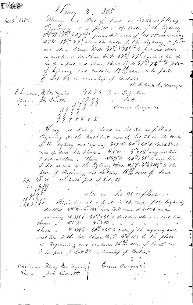
0335 2 pages scanned, please download to view all scans
Download 0335.tif
GIS Data
Latitude:
41.0324699999999
Longitude:
-81.64463
Identification
Survey identifier:
0335
Context
Original township:
Norton
Community list:
Norton
Surveyed on:
01/03/1853
Description
Owner:
Hoch, Blocker
Description:
79.71 ACRES IN LOT 35; 33
Primary road:
Secondary road:
Near intersection:
Acreage:
79.71
Survey Locators
Tract list:
Lot list:
35 &36
Section list:
Quarter:
Surveyor
Surveyor number:
Surveyor name:
Company:
Summit County Surveyor
Document Data
Scan File Name:
0335.tif
Scan Pages:
2
Drawer location:
Survey Book 1 Pg 469