Toggle navigation
Survey Documents
Advanced Search
Supporting Data
Companies
Surveyors
Communities
Original Townships
APIs
Survey Documents API
Tutorial
About
Contact
Search
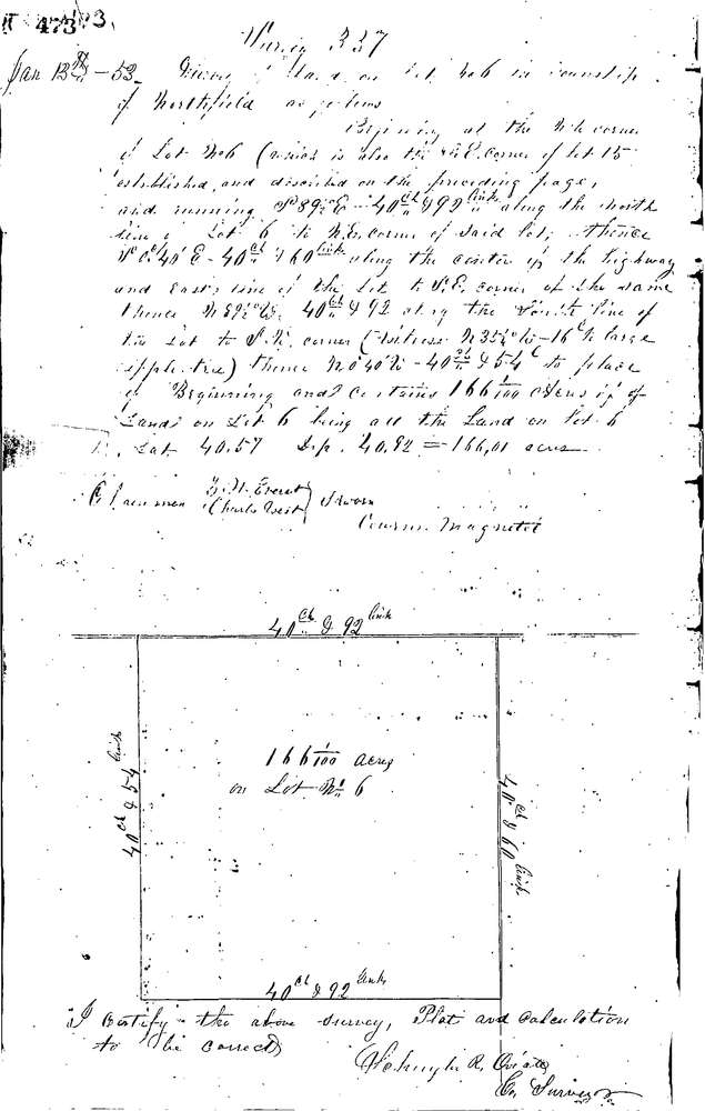
0337
Download 0337.TIF
GIS Data
Latitude:
41.3105799999999
Longitude:
-81.49215
Identification
Survey identifier:
0337
Context
Original township:
Northfield
Community list:
Northfield
Surveyed on:
01/13/1853
Description
Owner:
Armstead
Description:
166.01 ACRES
Primary road:
Secondary road:
Near intersection:
Acreage:
166.01
Survey Locators
Tract list:
Lot list:
6
Section list:
Quarter:
Surveyor
Surveyor number:
Surveyor name:
Company:
Summit County Surveyor
Document Data
Scan File Name:
0337.TIF
Scan Pages:
1
Drawer location:
Survey Book 1 Pg 473