Toggle navigation
Survey Documents
Advanced Search
Supporting Data
Companies
Surveyors
Communities
Original Townships
APIs
Survey Documents API
Tutorial
About
Contact
Search
0351
Download 0351.TIF
GIS Data
Latitude:
41.2299399999998
Longitude:
-81.58982
Identification
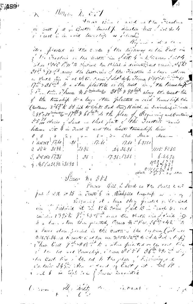
Survey identifier:
0351
Context
Original township:
Boston
Community list:
Boston
Surveyed on:
04/01/1853
Description
Owner:
Viall
Description:
55.79 AC IN FRAC. BETWEEN LOT 4, TR. 2 & W.L. TWP
Primary road:
Secondary road:
Near intersection:
Acreage:
55.79
Survey Locators
Tract list:
Lot list:
Frac
Section list:
Quarter:
Surveyor
Surveyor number:
Surveyor name:
Company:
Summit County Surveyor
Document Data
Scan File Name:
0351.TIF
Scan Pages:
1
Drawer location:
Survey Book 1 Pg 489