Toggle navigation
Survey Documents
Advanced Search
Supporting Data
Companies
Surveyors
Communities
Original Townships
APIs
Survey Documents API
Tutorial
About
Contact
Search
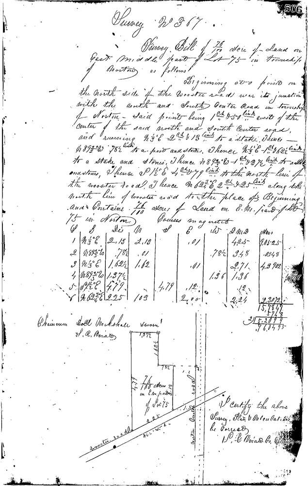
0367
Download 0367.TIF
GIS Data
Latitude:
41.0059799999999
Longitude:
-81.63939
Identification
Survey identifier:
0367
Context
Original township:
Norton
Community list:
Norton
Surveyed on:
03/21/1853
Description
Owner:
Foster
Description:
0.76 ACRES IN E. MIDDLE PAT OF LOT
Primary road:
Wooster Rd
Secondary road:
Near intersection:
31st St
Acreage:
0.76
Survey Locators
Tract list:
Lot list:
75
Section list:
Quarter:
Surveyor
Surveyor number:
Surveyor name:
Company:
Summit County Surveyor
Document Data
Scan File Name:
0367.TIF
Scan Pages:
1
Drawer location:
Survey Book 1 Pg 506