Toggle navigation
Survey Documents
Advanced Search
Supporting Data
Companies
Surveyors
Communities
Original Townships
APIs
Survey Documents API
Tutorial
About
Contact
Search
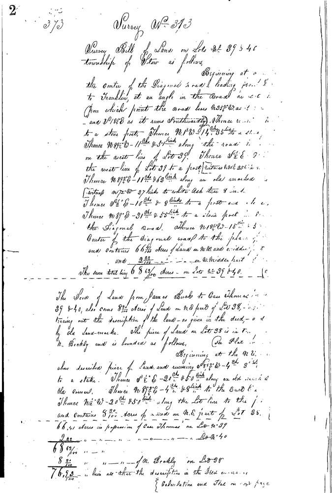
0373 2 pages scanned, please download to view all scans
Download 0373.tif
GIS Data
Latitude:
41.1635099999998
Longitude:
-81.41031
Identification
Survey identifier:
0373
Context
Original township:
Stow
Community list:
Stow
Surveyed on:
10/01/1853
Description
Owner:
Beckley, Thomas
Description:
8.30 AC IN 38, 66.41 AC. IN 39 & 2.22 AC. IN 40
Primary road:
Graham Rd
Secondary road:
Fishcreek Rd
Near intersection:
Acreage:
Survey Locators
Tract list:
Lot list:
38 - 40
Section list:
Quarter:
Surveyor
Surveyor number:
Surveyor name:
Company:
Summit County Surveyor
Document Data
Scan File Name:
0373.tif
Scan Pages:
2
Drawer location:
Survey Book 2 Pg 2