Toggle navigation
Survey Documents
Advanced Search
Supporting Data
Companies
Surveyors
Communities
Original Townships
APIs
Survey Documents API
Tutorial
About
Contact
Search
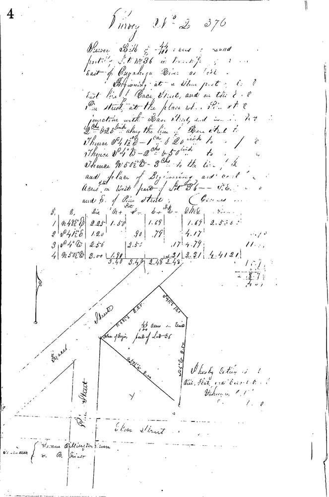
0376
Download 0376.TIF
GIS Data
Latitude:
41.2436699999999
Longitude:
-81.5464
Identification
Survey identifier:
0376
Context
Original township:
Boston
Community list:
Boston
Surveyed on:
11/28/1853
Description
Owner:
Unknown
Description:
0.44 ACRES IN W. PART OF LOT E. OF RIVER
Primary road:
Akron Peninsula Rd
Secondary road:
Near intersection:
Acreage:
0.44
Survey Locators
Tract list:
Lot list:
36
Section list:
Quarter:
Surveyor
Surveyor number:
Surveyor name:
Company:
Summit County Surveyor
Document Data
Scan File Name:
0376.TIF
Scan Pages:
1
Drawer location:
Survey Book 2 Pg 4