Toggle navigation
Survey Documents
Advanced Search
Supporting Data
Companies
Surveyors
Communities
Original Townships
APIs
Survey Documents API
Tutorial
About
Contact
Search
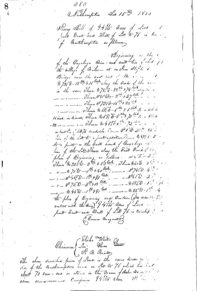
0380 2 pages scanned, please download to view all scans
Download 0380.tif
GIS Data
Latitude:
41.1629599999998
Longitude:
-81.57103
Identification
Survey identifier:
0380
Context
Original township:
Northampton
Community list:
Northampton
Surveyed on:
12/15/1853
Description
Owner:
Hansford
Description:
94.6 AC. IN MID. PART OF LOT E. & W. E. OF RIVER
Primary road:
Bath Rd
Secondary road:
Near intersection:
Acreage:
94.6
Survey Locators
Tract list:
Lot list:
76
Section list:
Quarter:
Surveyor
Surveyor number:
Surveyor name:
Company:
Summit County Surveyor
Document Data
Scan File Name:
0380.tif
Scan Pages:
2
Drawer location:
Survey Book 2 Pg 8