Toggle navigation
Survey Documents
Advanced Search
Supporting Data
Companies
Surveyors
Communities
Original Townships
APIs
Survey Documents API
Tutorial
About
Contact
Search
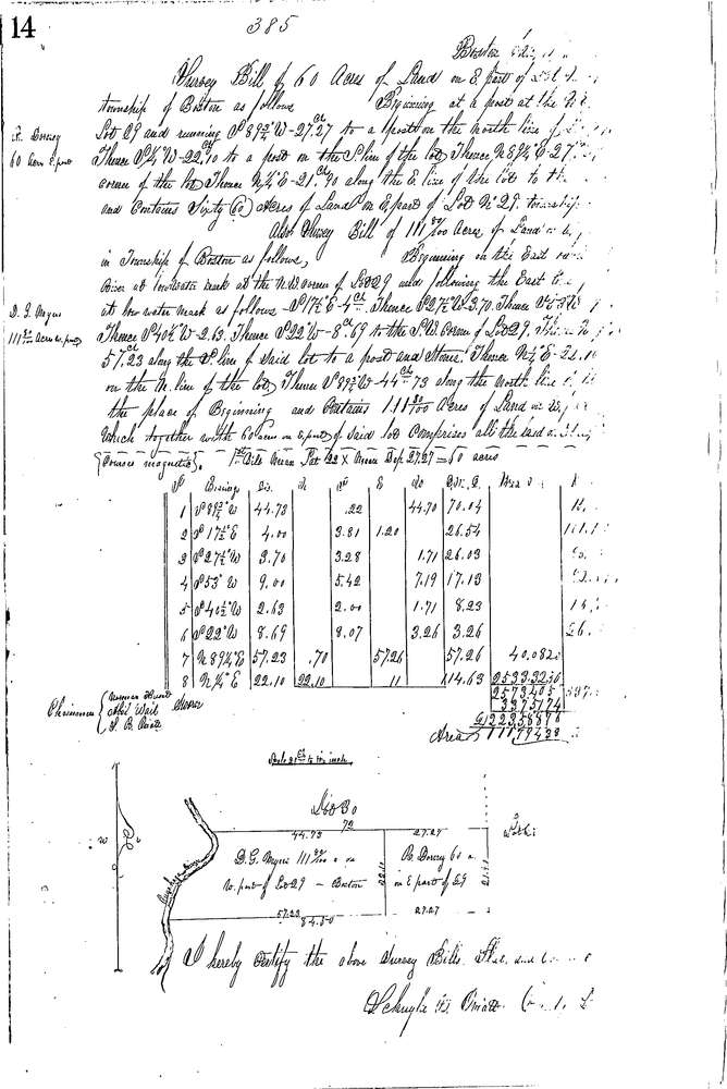
0385
Download 0385.TIF
GIS Data
Latitude:
41.2053399999999
Longitude:
-81.5597
Identification
Survey identifier:
0385
Context
Original township:
Boston
Community list:
Boston
Surveyed on:
01/11/1854
Description
Owner:
Dorney, Myers
Description:
171.80 ACRES ALL OF LOT E. OF RIVER
Primary road:
Secondary road:
Near intersection:
Acreage:
171.8
Survey Locators
Tract list:
Lot list:
79
Section list:
Quarter:
Surveyor
Surveyor number:
Surveyor name:
Company:
Summit County Surveyor
Document Data
Scan File Name:
0385.TIF
Scan Pages:
1
Drawer location:
Survey Book 2 Pg 14