Toggle navigation
Survey Documents
Advanced Search
Supporting Data
Companies
Surveyors
Communities
Original Townships
APIs
Survey Documents API
Tutorial
About
Contact
Search
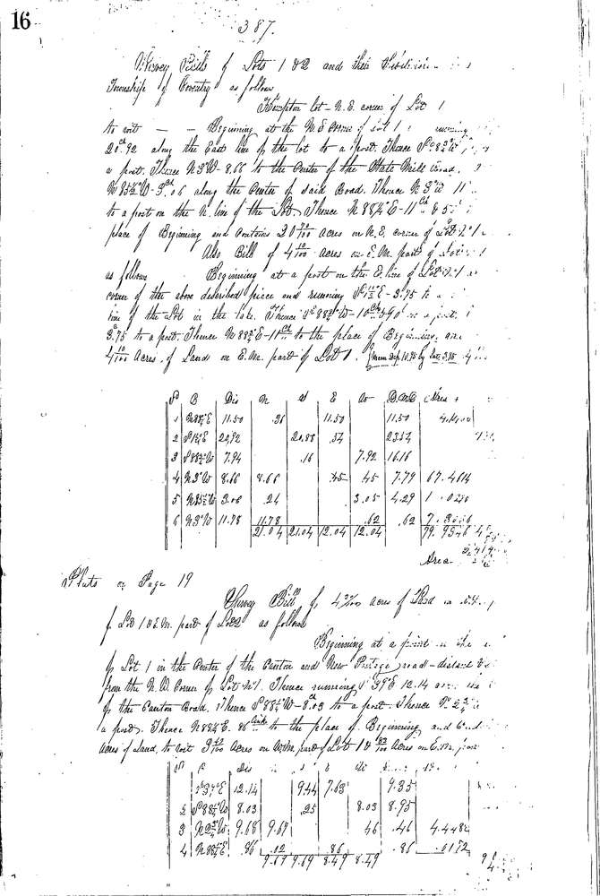
0387 4 pages scanned, please download to view all scans
Download 0387.tif
GIS Data
Latitude:
40.9972699999999
Longitude:
-81.55756
Identification
Survey identifier:
0387
Context
Original township:
Coventry
Community list:
Coventry
Surveyed on:
03/18/1854
Description
Owner:
Kempton, Dickerhoof, Rex, Whaler, Lockwood, Garl
Description:
VARIOUS PARCELS OF LAND
Primary road:
Manchester Rd
Secondary road:
State St
Near intersection:
State Mill Rd
Acreage:
Survey Locators
Tract list:
14
Lot list:
1, 2
Section list:
Quarter:
Surveyor
Surveyor number:
Surveyor name:
Company:
Summit County Surveyor
Document Data
Scan File Name:
0387.tif
Scan Pages:
4
Drawer location:
Survey Book 2 Pg 16