Toggle navigation
Survey Documents
Advanced Search
Supporting Data
Companies
Surveyors
Communities
Original Townships
APIs
Survey Documents API
Tutorial
About
Contact
Search
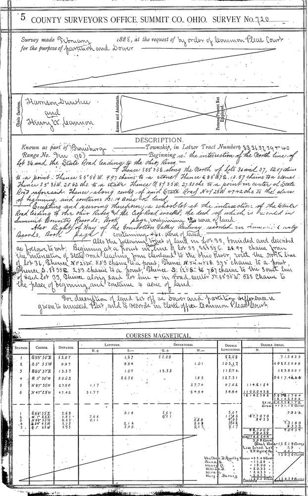
0720 2 pages scanned, please download to view all scans
Download 0720.tif
GIS Data
Latitude:
41.3012899999999
Longitude:
-81.41228
Identification
Survey identifier:
0720
Context
Original township:
Twinsburg
Community list:
Twinsburg
Surveyed on:
02/01/1885
Description
Owner:
Common Pleas Court
Description:
ODELL APPLEBY ESTATE
Primary road:
Aurora Rd
Secondary road:
Ravenna Rd
Near intersection:
Herrick Rd
Acreage:
Survey Locators
Tract list:
Lot list:
36, 37
Section list:
Quarter:
Surveyor
Surveyor number:
Surveyor name:
Company:
Summit County Surveyor
Document Data
Scan File Name:
0720.tif
Scan Pages:
2
Drawer location:
Survey Book 3 Pg 5