Toggle navigation
Survey Documents
Advanced Search
Supporting Data
Companies
Surveyors
Communities
Original Townships
APIs
Survey Documents API
Tutorial
About
Contact
Search
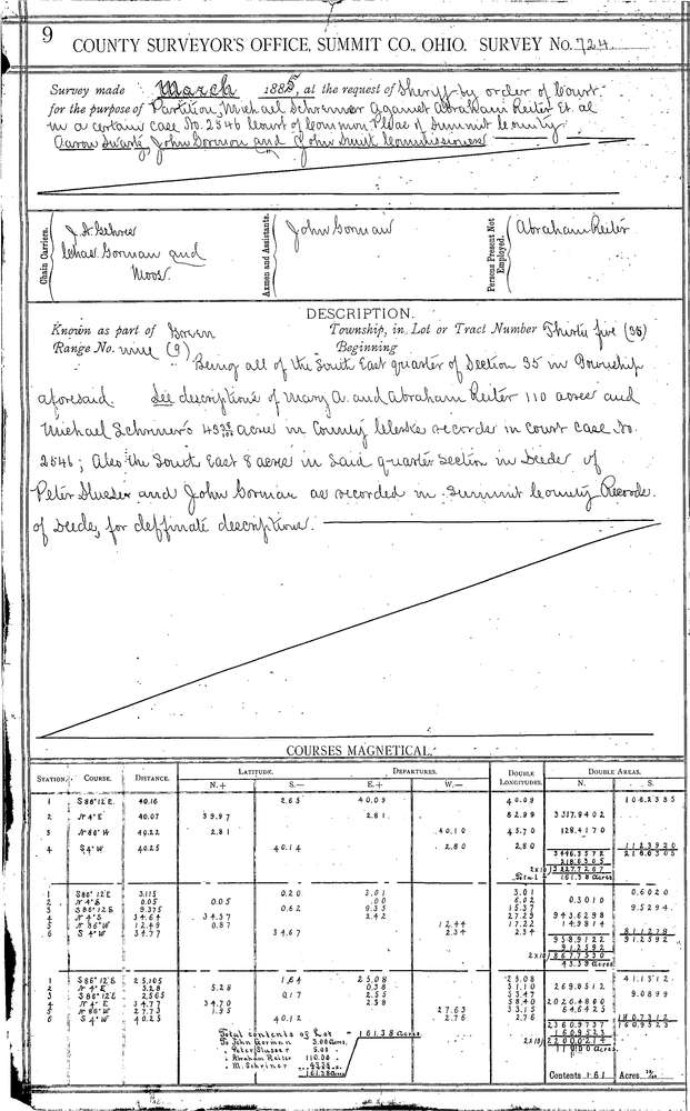
0724 2 pages scanned, please download to view all scans
Download 0724.tif
GIS Data
Latitude:
40.9117099999998
Longitude:
-81.44348
Identification
Survey identifier:
0724
Context
Original township:
Green
Community list:
Green
Surveyed on:
04/01/1885
Description
Owner:
Shriner, Reiter
Description:
IN S.E. 1/4 OF SEC.
Primary road:
Greensburg Rd
Secondary road:
Lauby Rd
Near intersection:
Mt. Pleasant Rd
Acreage:
Survey Locators
Tract list:
Lot list:
Section list:
35
Quarter:
Surveyor
Surveyor number:
Surveyor name:
Company:
Summit County Surveyor
Document Data
Scan File Name:
0724.tif
Scan Pages:
2
Drawer location:
Survey Book 3 Pg 9