Toggle navigation
Survey Documents
Advanced Search
Supporting Data
Companies
Surveyors
Communities
Original Townships
APIs
Survey Documents API
Tutorial
About
Contact
Search
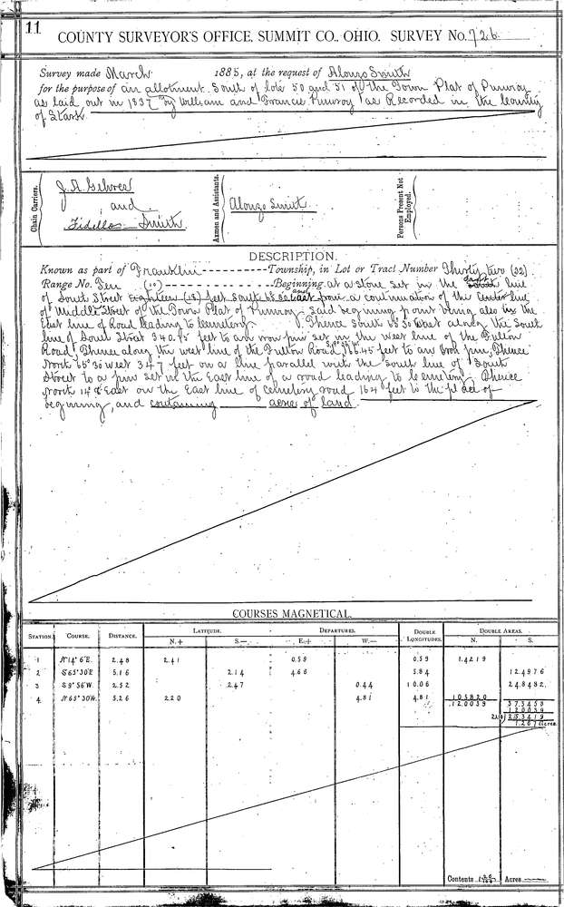
0726 2 pages scanned, please download to view all scans
Download 0726.tif
GIS Data
Latitude:
40.9257599999998
Longitude:
-81.62865
Identification
Survey identifier:
0726
Context
Original township:
Franklin
Community list:
Clinton
Surveyed on:
04/01/1885
Description
Owner:
Smith
Description:
A. SMITH'S ADDITION TO TOWN OF PUMROY
Primary road:
South St
Secondary road:
Middle St
Near intersection:
Fulton St
Acreage:
Survey Locators
Tract list:
Lot list:
Section list:
32
Quarter:
Surveyor
Surveyor number:
Surveyor name:
Company:
Summit County Surveyor
Document Data
Scan File Name:
0726.tif
Scan Pages:
2
Drawer location:
Survey Book 3 Pg 11