Toggle navigation
Survey Documents
Advanced Search
Supporting Data
Companies
Surveyors
Communities
Original Townships
APIs
Survey Documents API
Tutorial
About
Contact
Search
0730 2 pages scanned, please download to view all scans
Download 0730.tif
GIS Data
Latitude:
40.9286299999998
Longitude:
-81.57244
Identification
Survey identifier:
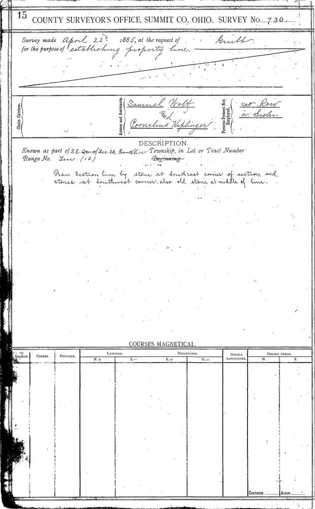
0730
Context
Original township:
Franklin
Community list:
New Franklin
Surveyed on:
04/22/1855
Description
Owner:
Grubb
Description:
80.0 AC. IN S.E. 1/4 OF SEC.
Primary road:
Secondary road:
Near intersection:
Acreage:
80.0
Survey Locators
Tract list:
Lot list:
Section list:
26
Quarter:
Surveyor
Surveyor number:
Surveyor name:
Company:
Summit County Surveyor
Document Data
Scan File Name:
0730.tif
Scan Pages:
2
Drawer location:
Survey Book 3 Pg 15