Toggle navigation
Survey Documents
Advanced Search
Supporting Data
Companies
Surveyors
Communities
Original Townships
APIs
Survey Documents API
Tutorial
About
Contact
Search
0732 2 pages scanned, please download to view all scans
Download 0732.tif
GIS Data
Latitude:
41.0996699999998
Longitude:
-81.5203
Identification
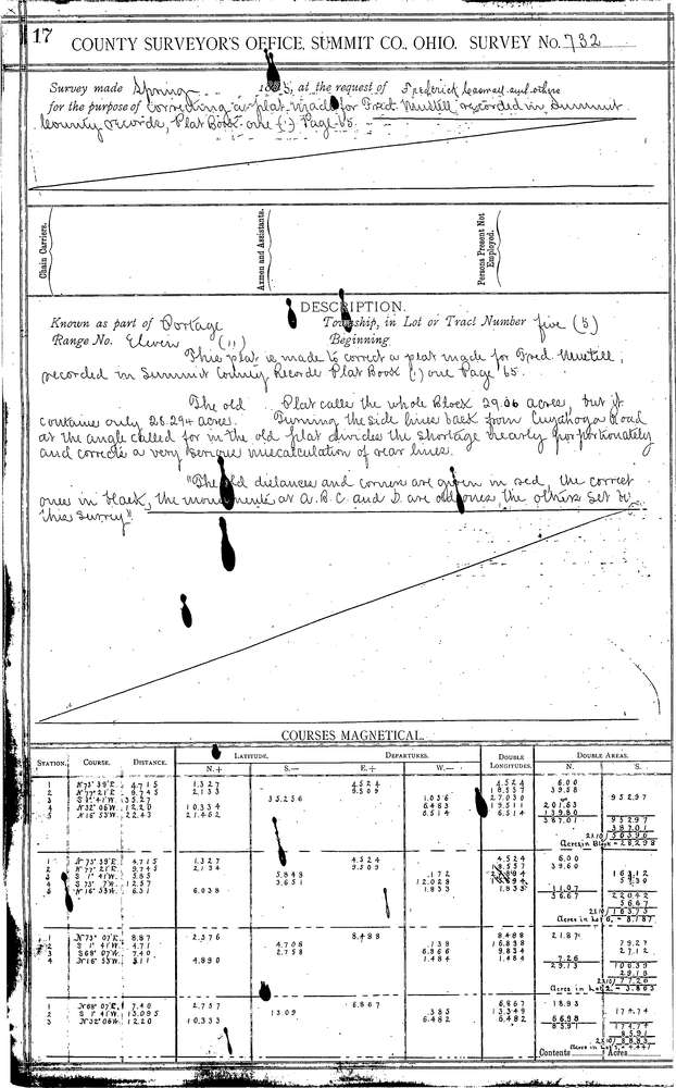
Survey identifier:
0732
Context
Original township:
Portage
Community list:
Akron
Surveyed on:
05/22/1885
Description
Owner:
Caswell
Description:
CORRECTING PLAT RECORDED IN P.B. 1, PG. 65
Primary road:
Tallmadge Ave
Secondary road:
Cuyahoga St
Near intersection:
Acreage:
Survey Locators
Tract list:
5
Lot list:
Section list:
Quarter:
Surveyor
Surveyor number:
Surveyor name:
Company:
Summit County Surveyor
Document Data
Scan File Name:
0732.tif
Scan Pages:
2
Drawer location:
Survey Book 3 Pg 17