Toggle navigation
Survey Documents
Advanced Search
Supporting Data
Companies
Surveyors
Communities
Original Townships
APIs
Survey Documents API
Tutorial
About
Contact
Search
0737 2 pages scanned, please download to view all scans
Download 0737.tif
GIS Data
Latitude:
41.0693299999998
Longitude:
-81.55184
Identification
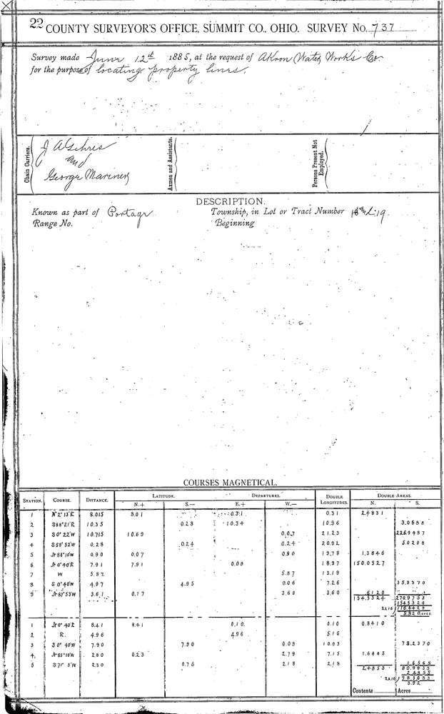
Survey identifier:
0737
Context
Original township:
Portage
Community list:
Akron
Surveyed on:
06/12/1885
Description
Owner:
Akron Water Works Co.
Description:
ONE PARCEL ON AKRON-COPLEY RD & ONE ON WOOSTER
Primary road:
Wooster Rd
Secondary road:
Near intersection:
Acreage:
Survey Locators
Tract list:
Lot list:
18 & 19 W.P.P.
Section list:
Quarter:
Surveyor
Surveyor number:
Surveyor name:
Company:
Summit County Surveyor
Document Data
Scan File Name:
0737.tif
Scan Pages:
2
Drawer location:
Survey Book 3 Pg 22