Toggle navigation
Survey Documents
Advanced Search
Supporting Data
Companies
Surveyors
Communities
Original Townships
APIs
Survey Documents API
Tutorial
About
Contact
Search
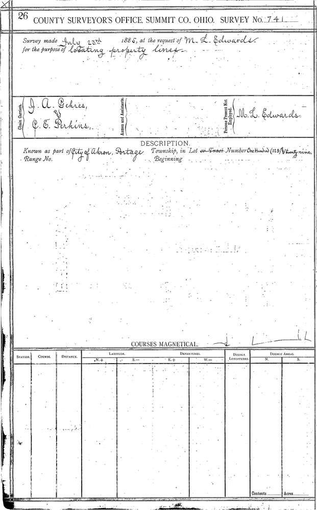
0741 2 pages scanned, please download to view all scans
Download 0741.tif
GIS Data
Latitude:
41.0764499999999
Longitude:
-81.51987
Identification
Survey identifier:
0741
Context
Original township:
Portage
Community list:
Akron
Surveyed on:
07/23/1855
Description
Owner:
Edwards
Description:
BROADWAY, EXCHANGE ST TO BUCHTEL AVE IN TOWN PLAT
Primary road:
Exchange St
Secondary road:
High St
Near intersection:
Broadway St
Acreage:
Survey Locators
Tract list:
Lot list:
129
Section list:
Quarter:
Surveyor
Surveyor number:
Surveyor name:
Company:
Summit County Surveyor
Document Data
Scan File Name:
0741.tif
Scan Pages:
2
Drawer location:
Survey Book 3 Pg 26