Toggle navigation
Survey Documents
Advanced Search
Supporting Data
Companies
Surveyors
Communities
Original Townships
APIs
Survey Documents API
Tutorial
About
Contact
Search
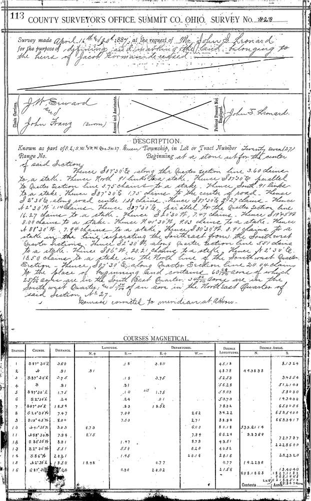
0828 2 pages scanned, please download to view all scans
Download 0828.tif
GIS Data
Latitude:
40.9271399999999
Longitude:
-81.46601
Identification
Survey identifier:
0828
Context
Original township:
Green
Community list:
Green
Surveyed on:
04/20/1887
Description
Owner:
Leonard
Description:
60.69 AC. IN S.E.- S.W. &N.W. 1/4 SECTIONS
Primary road:
Massillon Rd
Secondary road:
Near intersection:
Acreage:
Survey Locators
Tract list:
Lot list:
Section list:
27
Quarter:
Surveyor
Surveyor number:
Surveyor name:
Company:
Summit County Surveyor
Document Data
Scan File Name:
0828.tif
Scan Pages:
2
Drawer location:
Survey Book 3 Pg 113