Toggle navigation
Survey Documents
Advanced Search
Supporting Data
Companies
Surveyors
Communities
Original Townships
APIs
Survey Documents API
Tutorial
About
Contact
Search
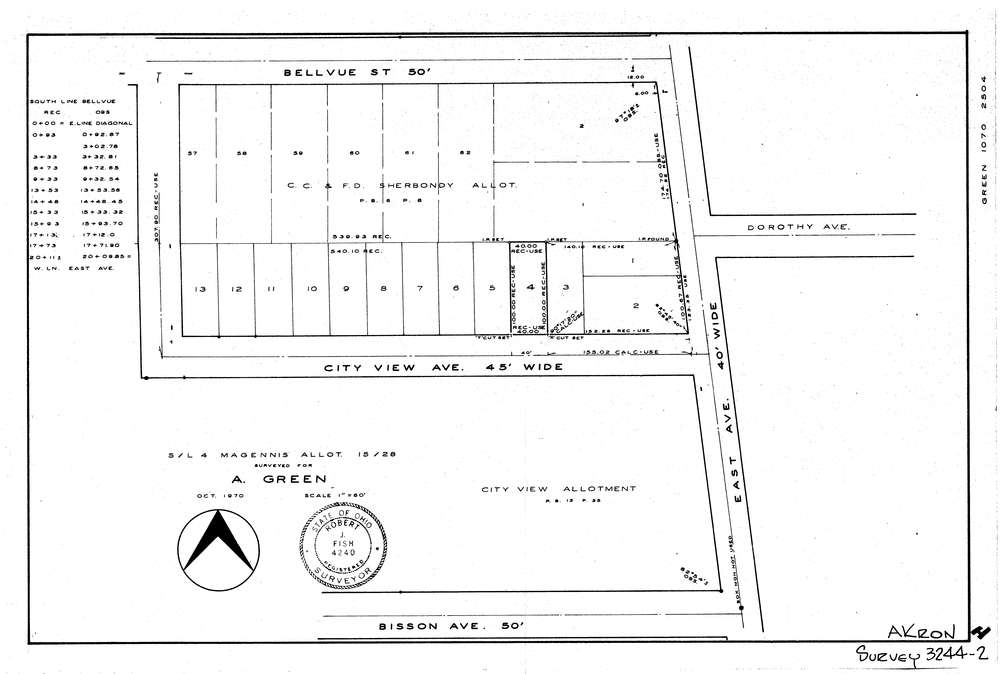
3244-2
Download lotsplits3244_2.tif
GIS Data
Latitude:
41.0734309999999
Longitude:
-81.548531
Identification
Survey identifier:
3244-2
Context
Original township:
Akron
Community list:
Akron
Surveyed on:
10/01/1970
Description
Owner:
Green
Description:
Magennis Allot. P.B. 15 Pg. 28 S/L 4
Primary road:
City View Ave
Secondary road:
Near intersection:
East Ave
Acreage:
Survey Locators
Tract list:
Lot list:
Section list:
Quarter:
Surveyor
Surveyor number:
4240
Surveyor name:
Fish, Robert J.
Company:
Document Data
Scan File Name:
lotsplits3244_2.tif
Scan Pages:
1
Drawer location: