Toggle navigation
Survey Documents
Advanced Search
Supporting Data
Companies
Surveyors
Communities
Original Townships
APIs
Survey Documents API
Tutorial
About
Contact
Search
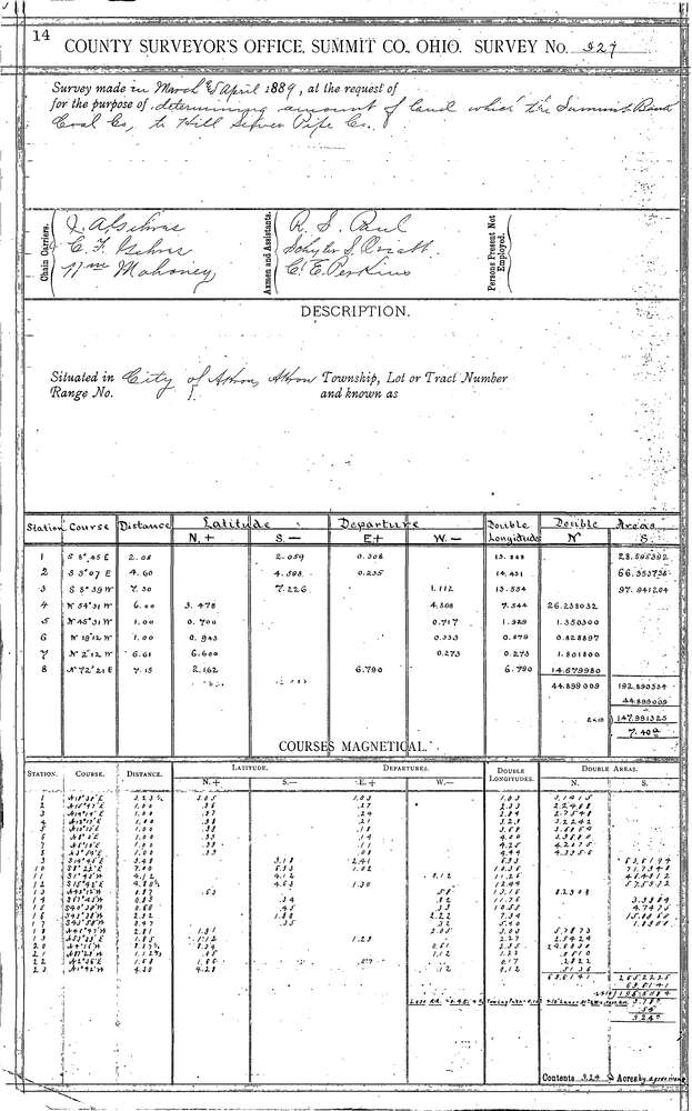
0927 2 pages scanned, please download to view all scans
Download 0927.tif
GIS Data
Latitude:
41.0764699999999
Longitude:
-81.48565
Identification
Survey identifier:
0927
Context
Original township:
Tallmadge
Community list:
Akron
Surveyed on:
04/01/1889
Description
Owner:
Summit Bank Coal Co. to Hill Sewer Pipe Co.
Description:
Property along O & P Canal
Primary road:
Bank St
Secondary road:
Case Ave
Near intersection:
Hazel St
Acreage:
Survey Locators
Tract list:
Lot list:
Section list:
Quarter:
Surveyor
Surveyor number:
Surveyor name:
Company:
Summit County Surveyor
Document Data
Scan File Name:
0927.tif
Scan Pages:
2
Drawer location:
Survey Book 4 Pg 14